*This post contains affiliate links, if you make a purchase I get a small commission
The island of São Miguel, one of nine in the middle of the Atlantic, has beautiful landscape, lots of hiking trails, and great cities like Ponta Delgada. There is so much to see and do on this island, it can be hard to choose. But if lush forest, dense vegetation and panoramic views are your thing, then hiking to the summit of Pico da Vara is an absolute must.
Pico de Vara
Not only the undisputed highest point of São Miguel island but also the spot with the most unpredictable weather conditions. Pico de Vara is 1,103 m high and is considered a special protection area known as Pico da Vara nature reserve. The mountain is nestled in an protected area surrounded by endemic vegetation like the largest remaining stand of the native laurel forest. Home of the critically endangered Azorean bullfinch.
From 2009-2013 the LIFE Sustainable Laurel Forest project has been developing ecological restoration plans and promoting their value for long-term sustainability. These forests are on the brink due to intense deforestation for conversion to agricultural lands and pastures. Along with this new invasive species of plants and animals have emerged. For more information on this project check out this report.
Best time to hike to the top of Pico da Vara
For the clearest days, hiking Pico da Vara is best done in the summer months. In the shoulder season clear days are hard to come by and you are more likely to be shrouded in clouds once you reach a certain point along your hike. However, this mountain does create it’s own weather and it may seem like a great day but the island’s highest peak will still be in cloud.
Permit to Hike
Because this is part of a Nature Preserve, the Azorean people do everything they can to ensure it’s survival. So, not only are there ongoing restoration projects, they only allow a certain number of people to hike to the peak on any given day.
In order to hike summit Pico de Vara you must apply for a permit. Basically, it just says you understand the value of the area and will “leave no trace” and respect the area. You can find the application online. It’s pretty quick and within a half hour they email you your permit.
A word of warning. The whole site is in Portuguese and we couldn’t figure out how to get it to translate so we had to guess what information they were asking for.
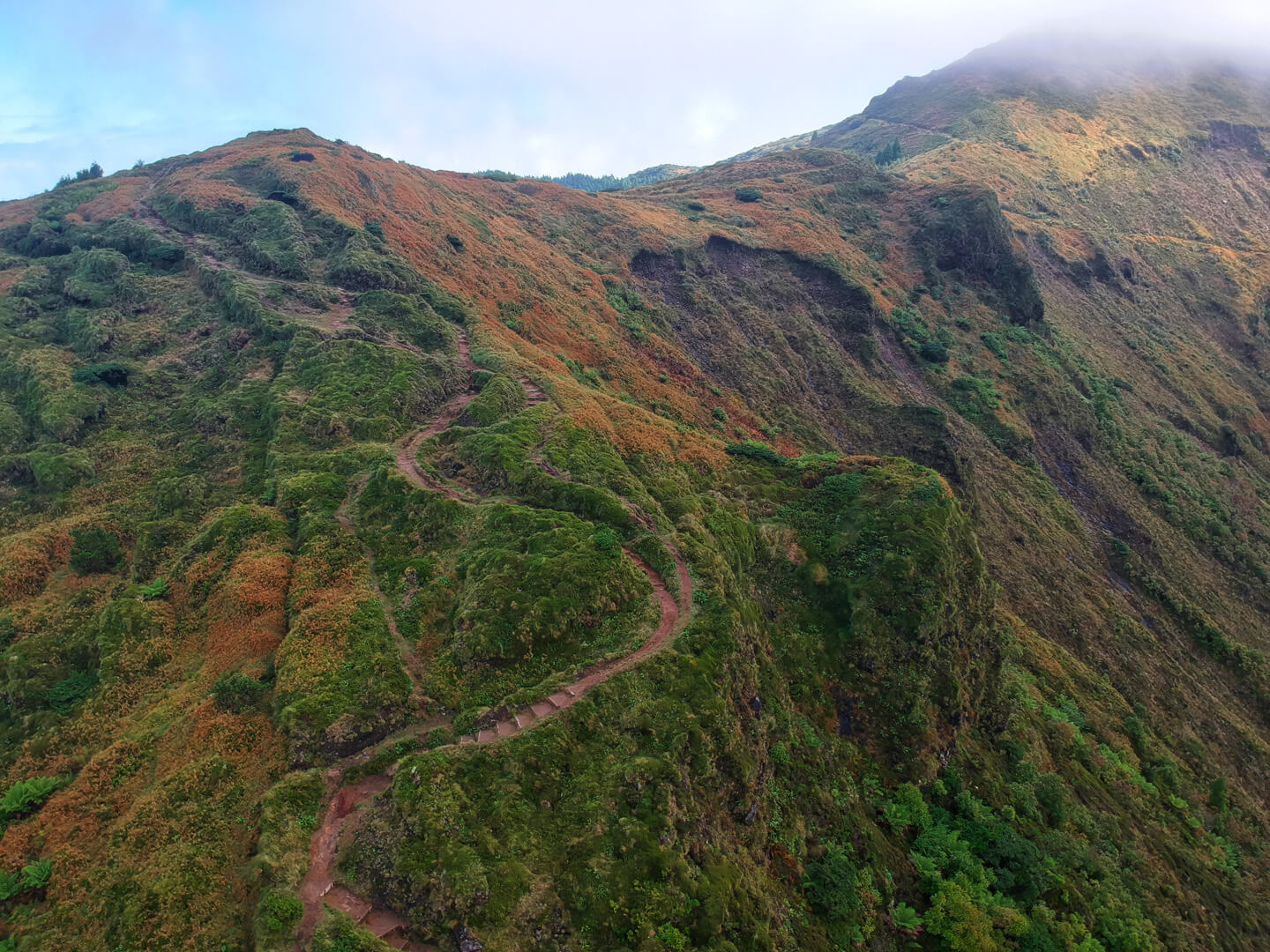
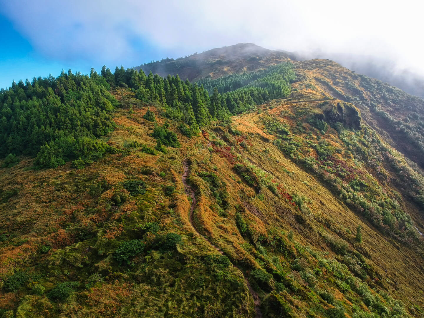
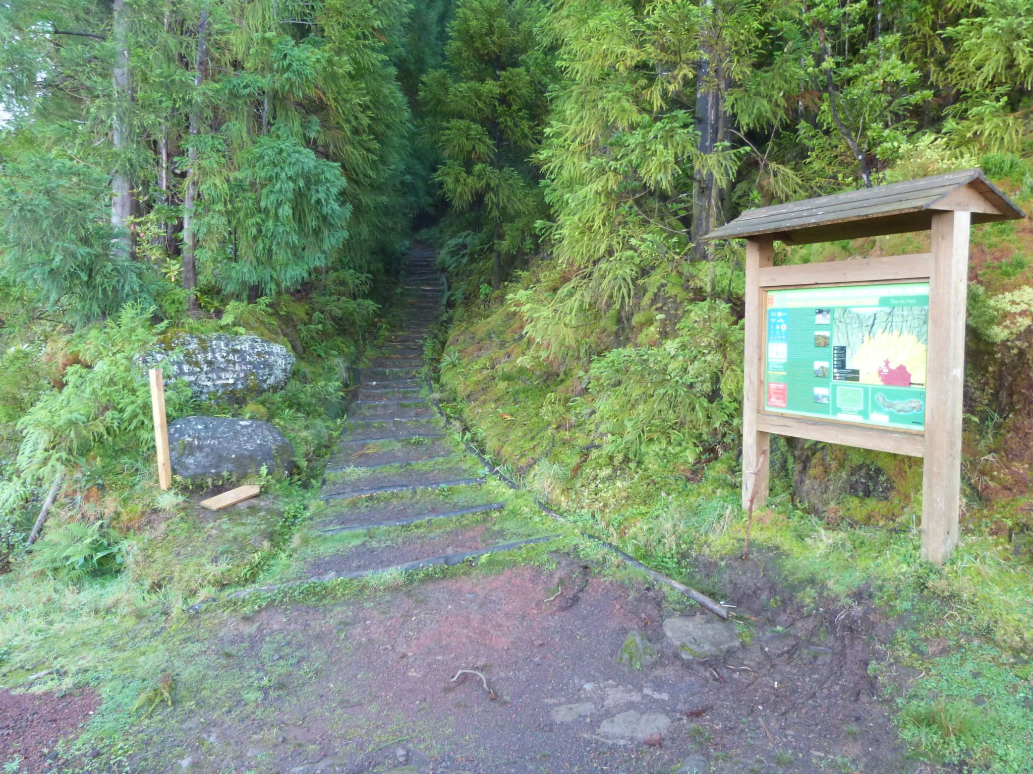
Hiking Pico de Vara
After driving down what can only be described as a logging dirt road, there is a small parking lot next to the trail head. All around you is a swath of forest. Watch the weather very closely before you head out. It is completely unpredictable and also highly unlikely that you will get a clear view from the top on any given day.
From reading information from guides who have hiked that peak a thousand times, it seems they have only ever seen the view once or twice. But if it’s a bad day, the views on the way up are also going to be diminished.
We also adjusted our plans in order to hike on a better day. And your permit allows for that, because honestly, no one is there to check if you even have a permit.
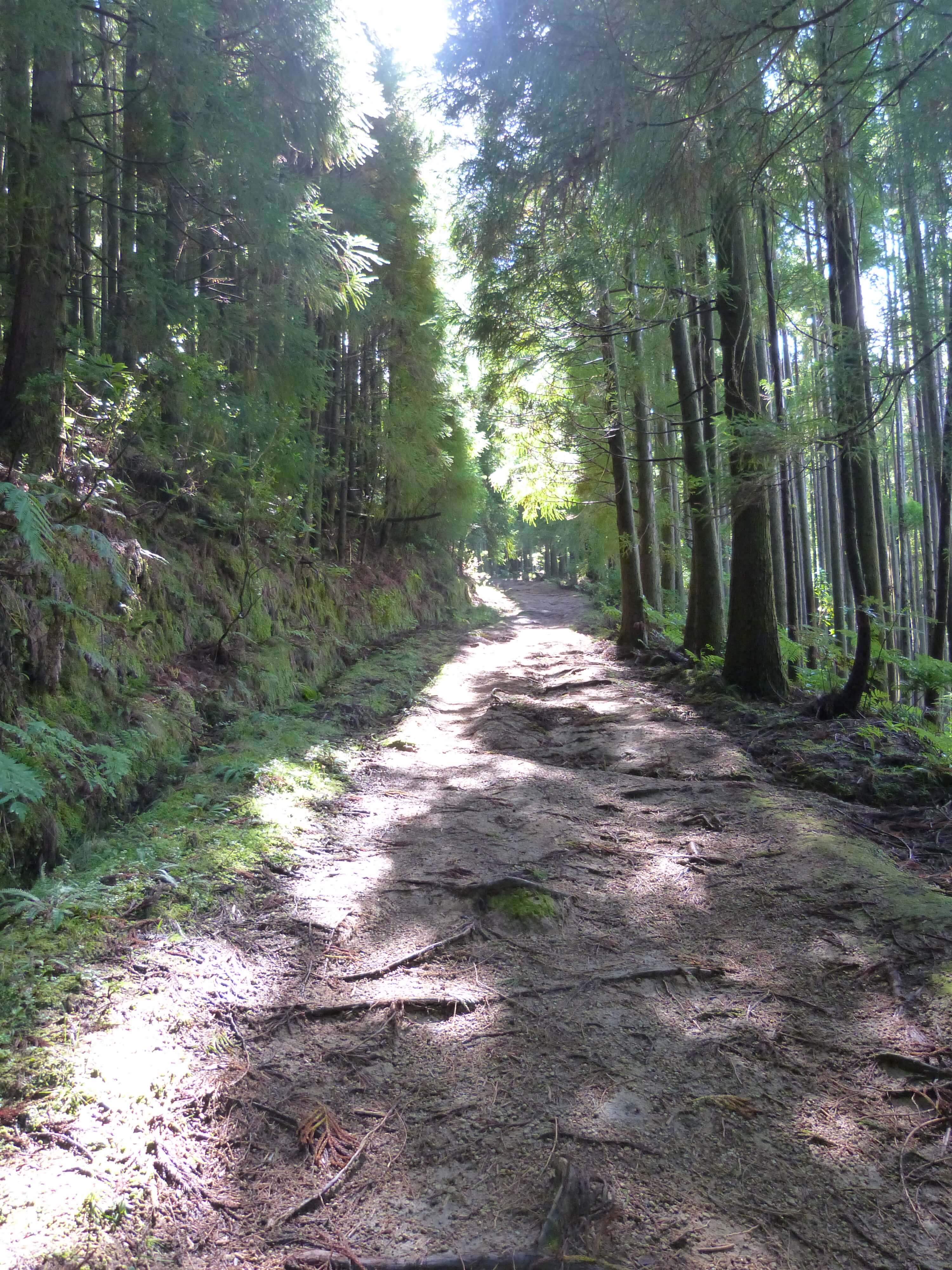
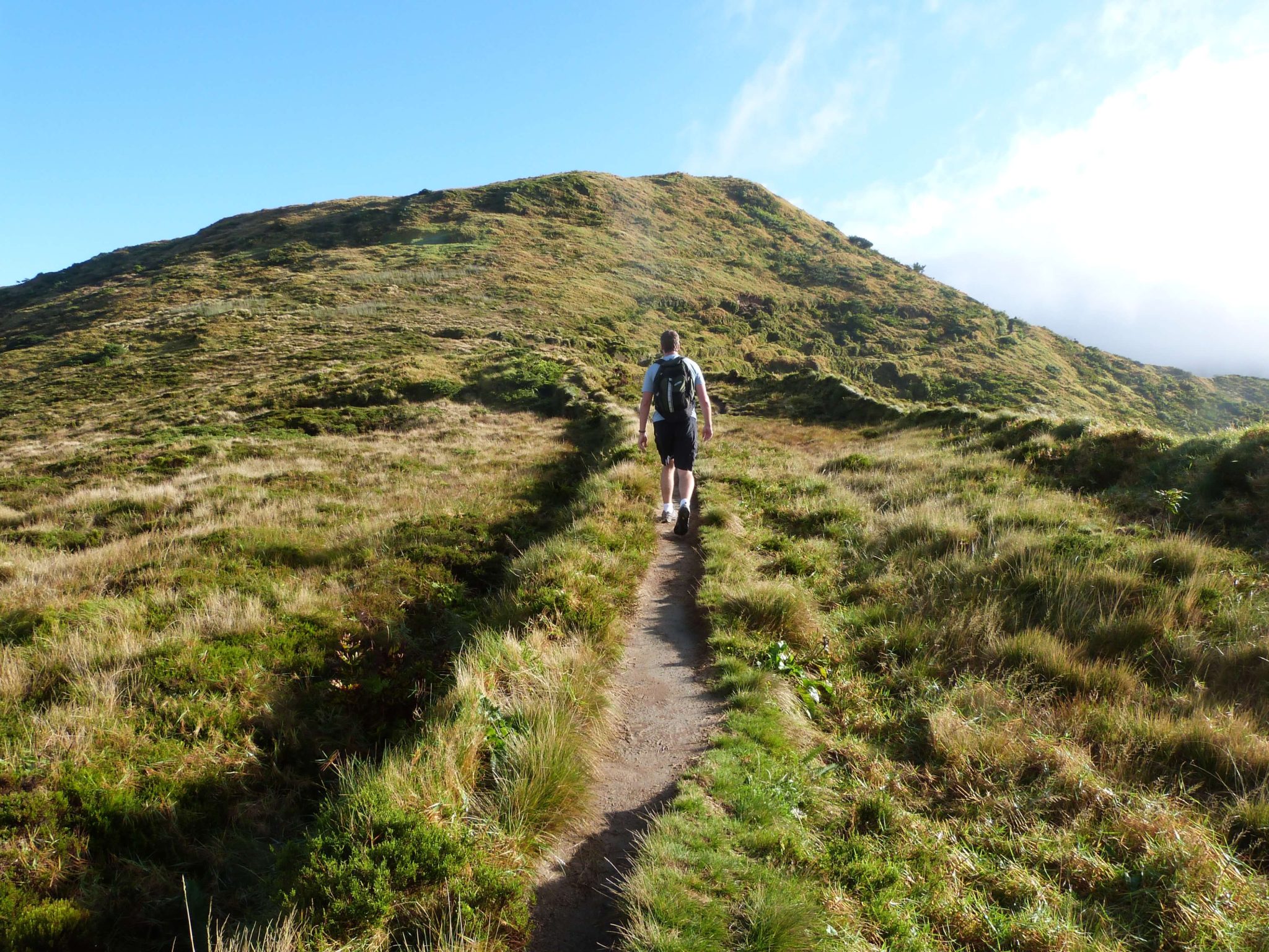
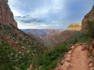
This scenic trail starts within a beautiful cedar forest on a well-maintained path, but quickly opens up into vast open areas surrounded by forest and birds chirping. I was constantly searching for the bullfinch, but we never saw one. The day that we hiked was a clear, warm, bright sort of day and I was thinking all along that we were going to have one hell of a view at the top.
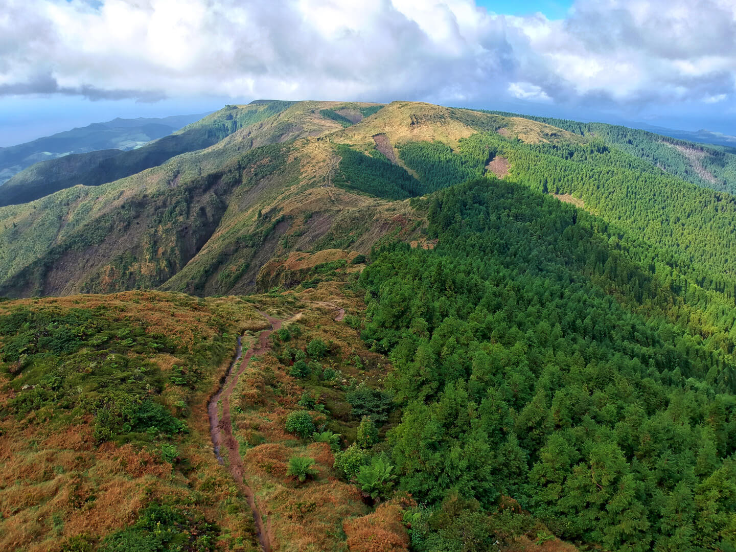
There were great views all around us as the ground slopped away on either side into deep valleys. The air was so clean and fresh you couldn’t help but breath in deeply every time you stopped to look around. It quickly became one of my favourite hikes.
But don’t take this hike lightly, it is not an easy hike, even though it starts out that way. The elevation gain is around 637 meters (2,090 feet) and you should be in fairly good condition to hike it, because there are not a lot of resources out there if something were to happen.
A little history
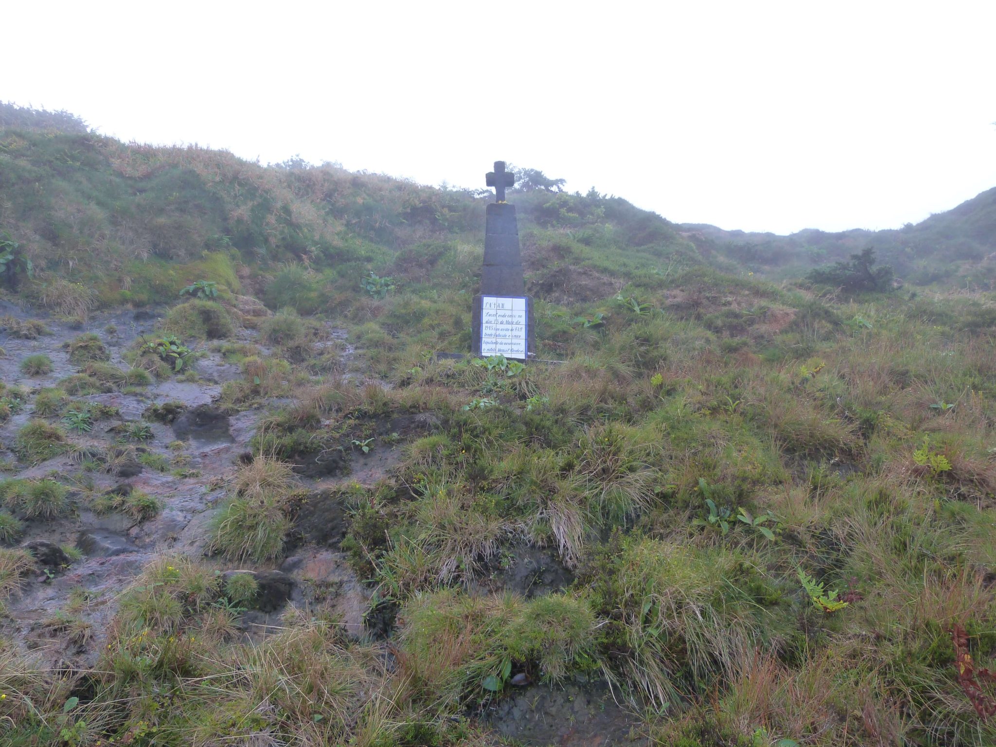
There is more to this mountain, however. It’s not just about the never-ending views of forest on one side and sparkling ocean on the other. There is a sad history here. Two planes, on two different occasions, crashed into this mountain.
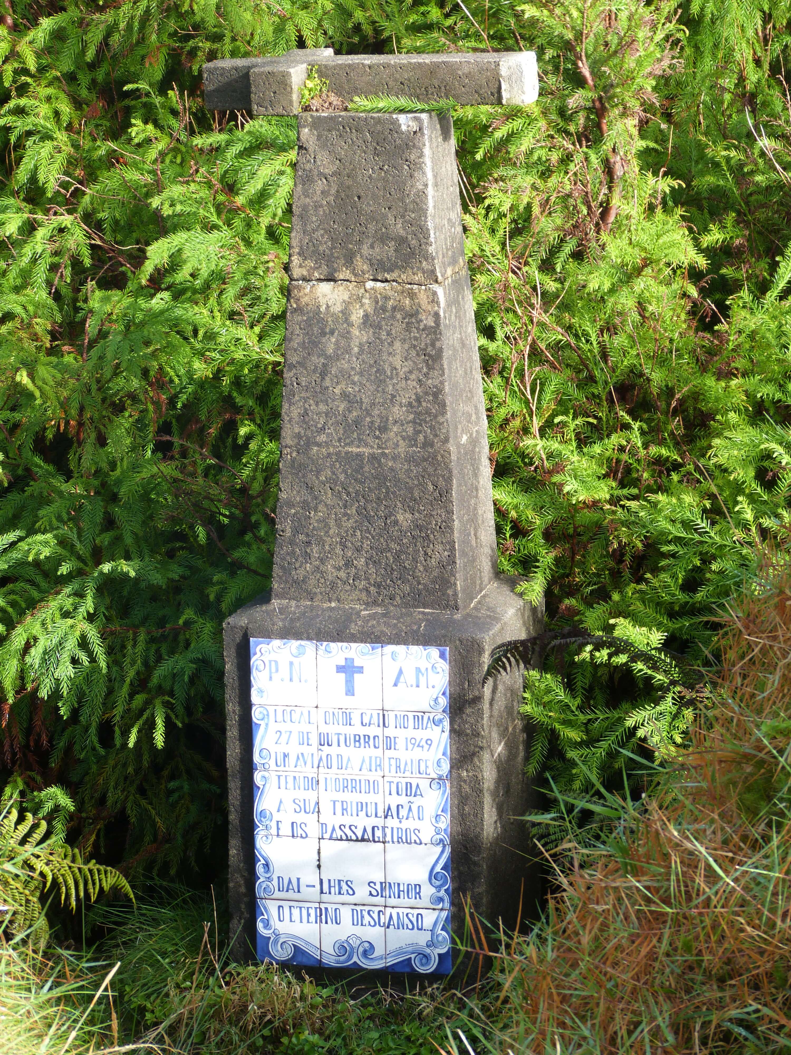
Both occurring in the 1940’s, one was an Air France flight where 48 people were killed. The wreckage catching fire and pieces of the plane were spread across an area of about 420 square meters. The other was an air force plane. Both have memorials that you can see along the route that are part of the trail’s highlights.
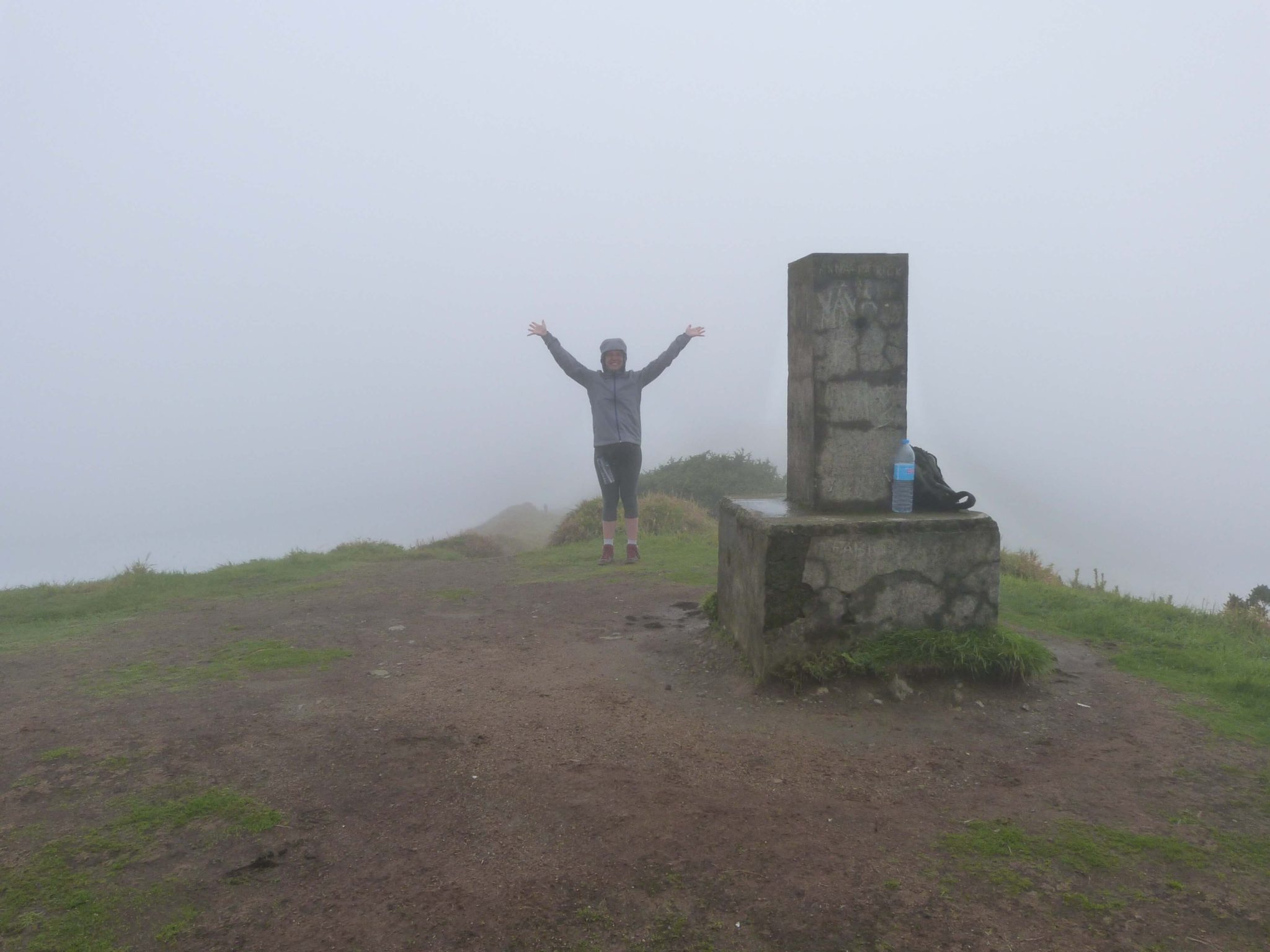
Summiting the highest mountain in São Miguel
Like I said along the route the day was perfect. However, looking towards the peak all we could see was a low hanging cloud. The peak was shrouded in mystery and a gray floating mass of cloud. The closer we got to the peak, the worse our visibility. Until finally, we reached the plateau at the summit and was immediately surrounded by thick, dense cloud cover with blasting wind and moisture.
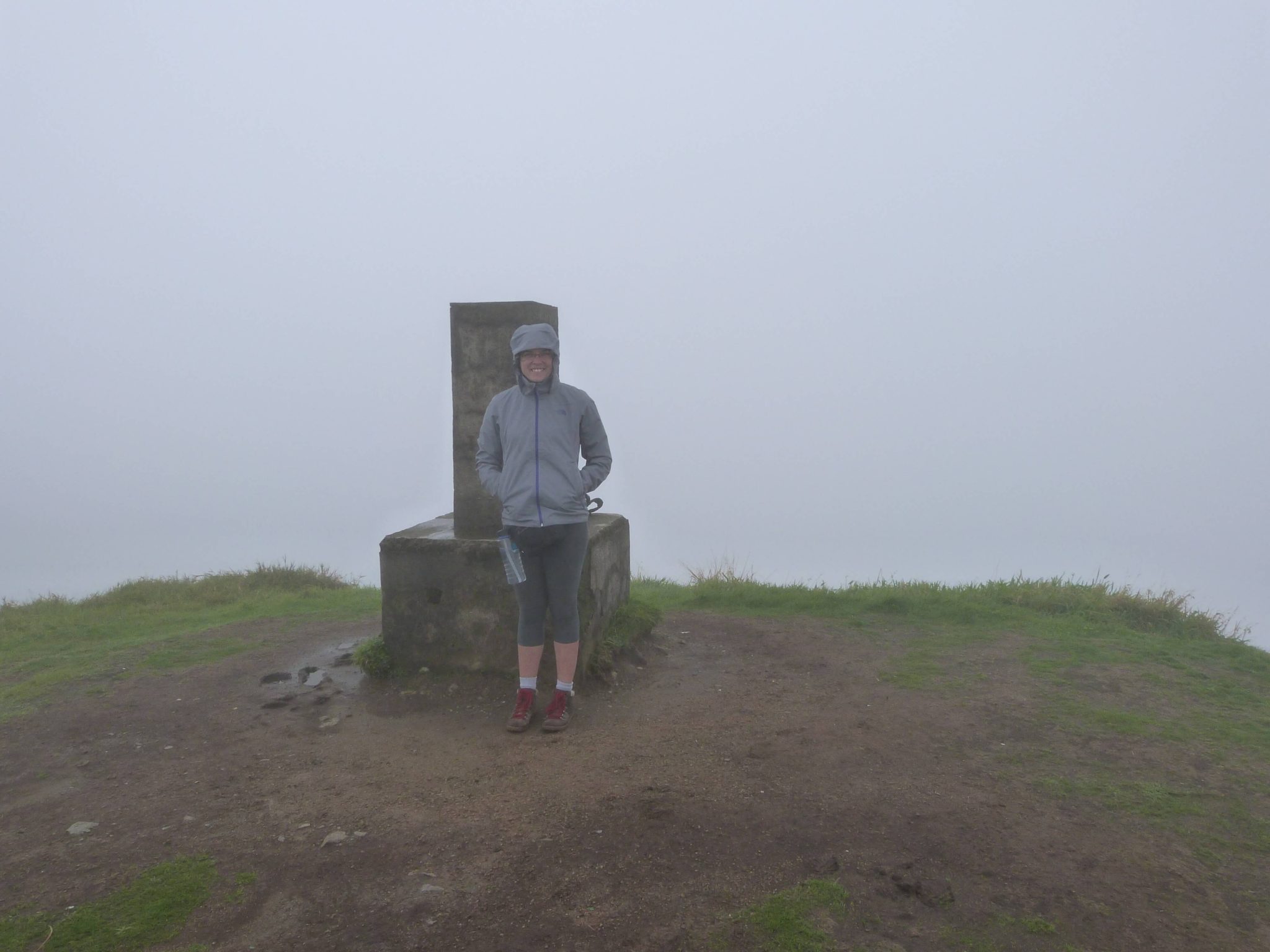
I am sure the 360-degree views are spectacular to witness (you can check them out here), but no matter how long we waited we were never afforded the opportunity. But it was still a spectacular hike and even with the cloud shrouding the peak, it was far from a disappointment. I sat atop that peak, camera ready, just in case there was a break in the clouds, feeling profoundly satisfied at what I had just accomplished.
Concluding thoughts
Hiking to the highest point of the island was a challenge, but completely worthwhile and a must do if you are visiting Sao Miguel. It was easily my favorite trail along with the Lagoa de Fogo hike (which you should also check out).
Heading to the Azores? Make sure to grab a copy of my guidebook The Azores: A guide for hikers.

Comments
Pingback: I've been nominated for a Liebster Award! - Wandering with a Dromomaniac
Pingback: The Ultimate Guide to Western São Miguel - Wandering with a Dromomaniac
Pingback: The Ultimate Guide to Eastern São Miguel - Wandering with a Dromomaniac %