
*This post contains affiliate links, if you click a link I make a small commission and you help support the blog
Whenever I am looking at destinations or hiking locations around the world, I have a tendency to look for the challenges. Something that will push my body to its limits. A way to see just what I am capable of. That’s when I discovered the presidential range in the White Mountains of New Hampshire.
Don’t get me wrong I also go to these places to get out into nature and experience the immense beauty of that area. But having that extra twist really gets my adrenaline pumping.
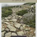
The Basics of the Presidential Traverse
What is the presidential traverse?
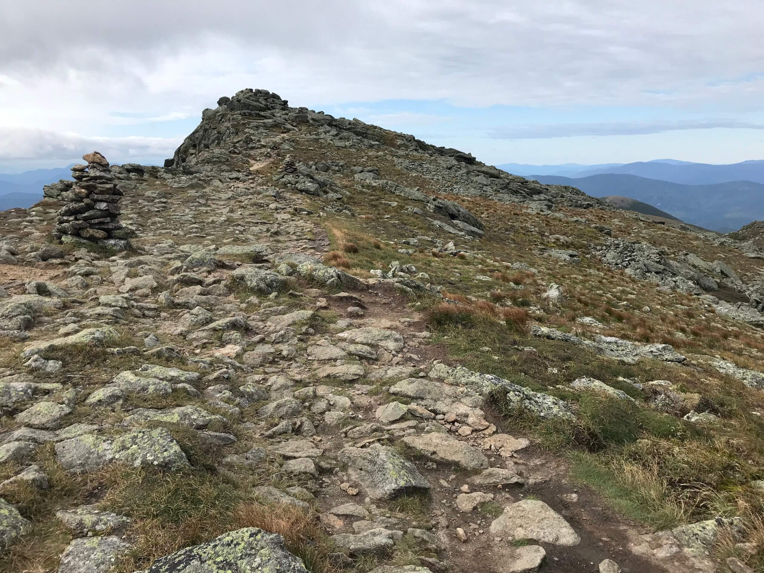
The presidential traverse is a series of 4000-ft mountains (some of the tallest peaks in the east) in the White Mountains of New Hampshire. Aptly named the mountains themselves are all named after various US presidents: Madison (5367-ft), Adams (5774-ft), Jefferson (5712-ft), Clay (5533-ft), Washington (6288-ft), Monroe (5384-ft), Franklin (5001-ft), Eisenhower (4780-ft), Pierce (4310-ft) and Jackson (4052-ft).
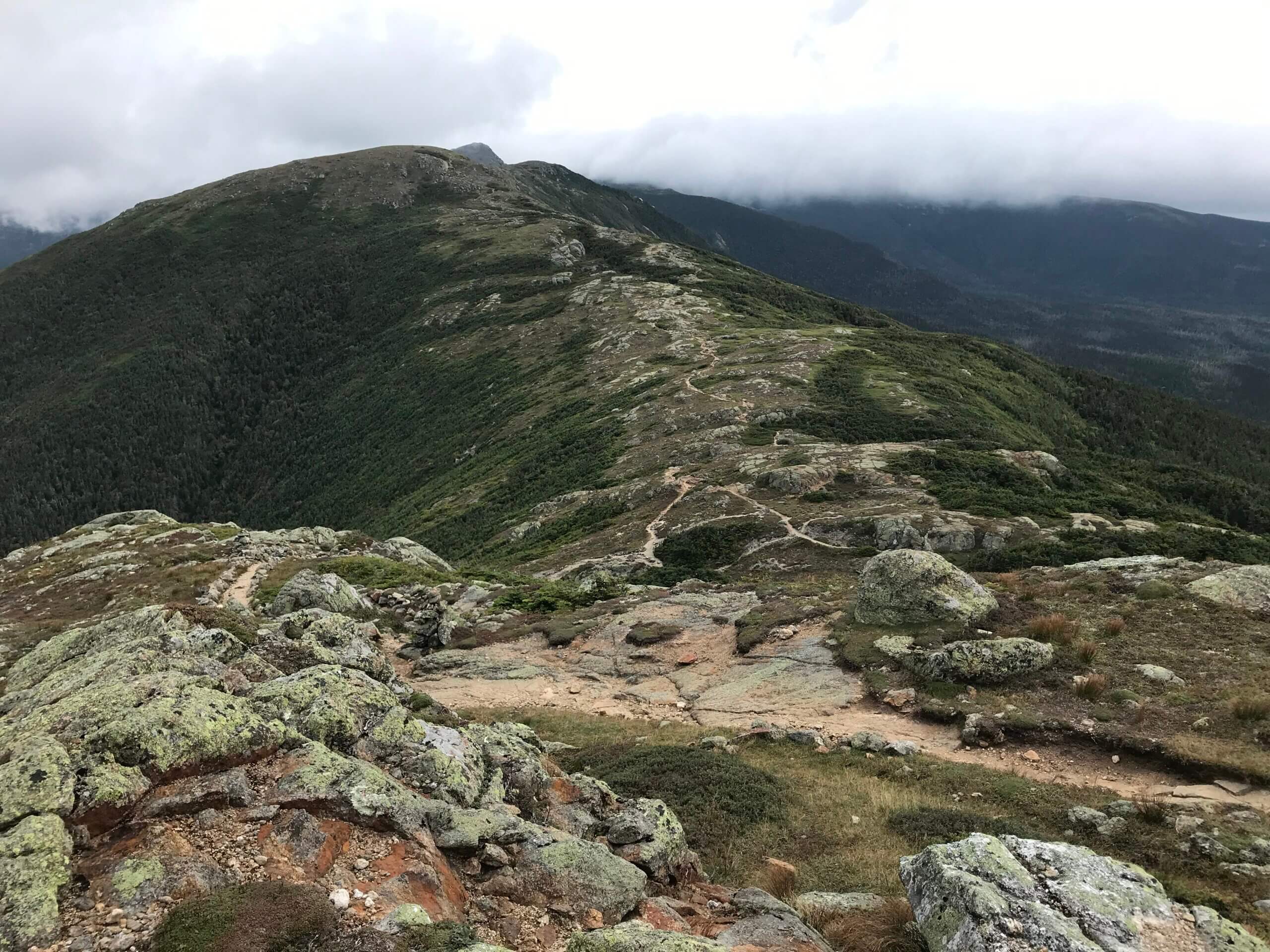
It is extremely rocky terrain with significant feet of elevation gain and loss throughout a trek that is largely above the tree line and can be rather exposed. You can make it a long hike over several days or plan a day hike to Mount Washington or some of the other mountains. The trek itself is around a 19-mile hike and most of the available water sources will be at the AMC mountain huts and on top of Mount Washington.
Where is it?
There are two main options for hiking this trail, Northbound or Southbound. Going southbound tends to be the most recommended because you get the hardest section out of the way with fresh legs (which I agree with).
Heading northbound begins at the Highland Center at Crawford Notch. If you are headed Southbound, you will begin at the trailhead to the base of Mount Madison.
If you are planning to hike solo, you can take an AMC shuttle to the start of the hike, saving you from figuring out parking logistics. Though the timetables aren’t always ideal, it’s the best way to get to the southbound trailhead when you aren’t arriving with two vehicles.
I parked at Crawford Notch and took the shuttle to the start of the trail, leaving Crawford Notch at 10AM, which in hindsight was not ideal if you only have 2 days to hike the whole trail. You really need to start earlier than that. I ended up skipping a bunch of peaks (including Washington) and I still arrived at the hut in the dark.
Logistics
Where to stay
There are several options along the way. It all depends on your plan. You can do the challenge and hike the entire trail in one long day, in which case you will camp at the beginning or end of the trail. Or you can tackle it over several days, which is the best way to really experience the trail.
The Appalachian Mountain Club (AMC) operates several alpine huts along the trail, eight to be exact. Not all fall along the presidential traverse but offer hikers the ability to hike into these huts, enjoy a place to sleep and some great food.
Madison Spring Hut (44.328037, -71.283569) was originally built in 1888 but has been newly rebuilt and is the AMCs first high mountain hut. If you are hiking north to south, this is the first hut you will come across at around the 4-mile mark.
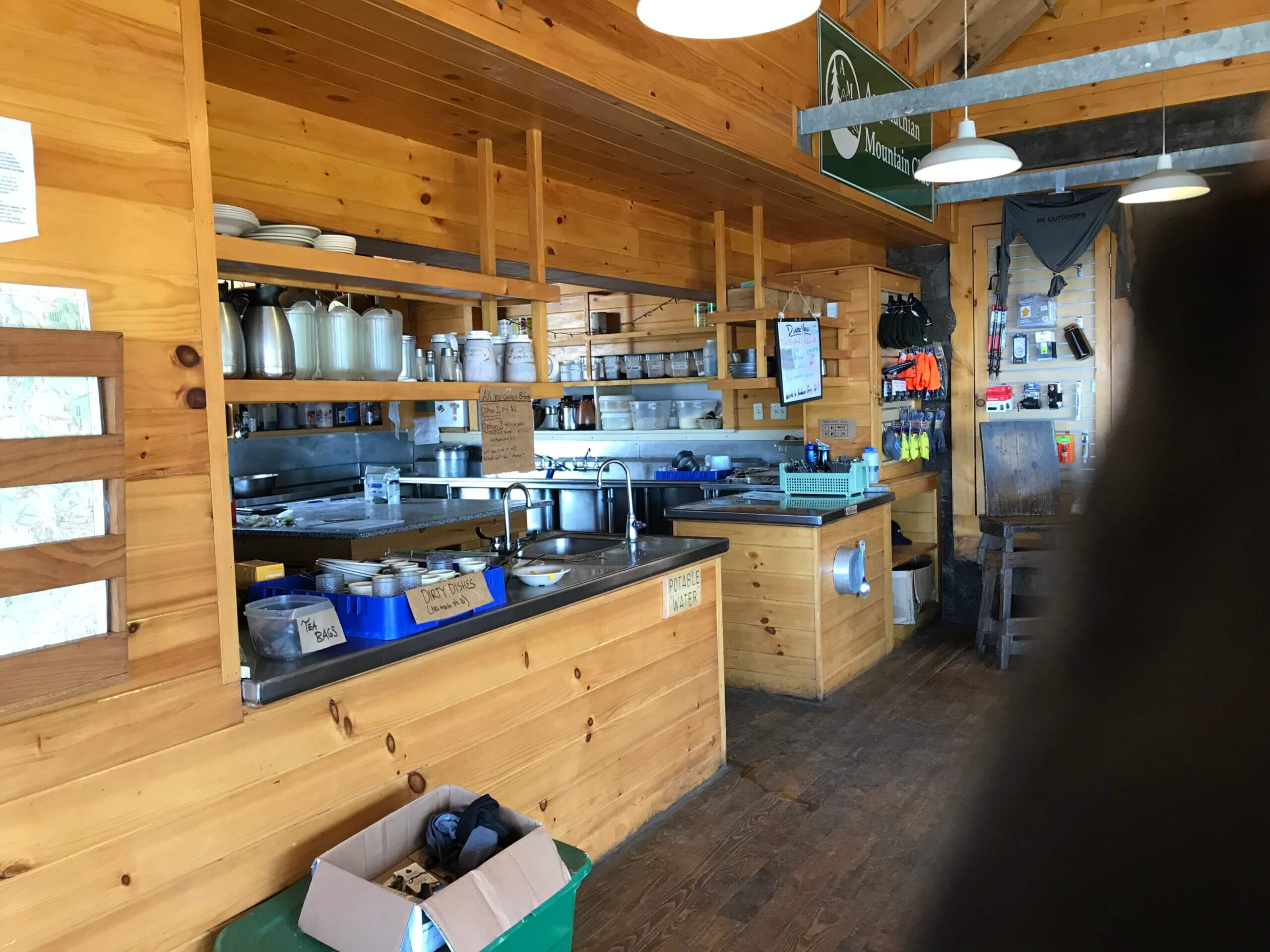
If you are just passing through the Madison hut is a good place to stop and fill up your water and check the forecast (they also have delicious little pastries you can buy for a couple dollars). The summit of Mount Madison is a slight backtrack from the actual trail.
So, you will first arrive at the hut and then you will need to go in the opposite direction of the main presidential traverse in order to summit this one.
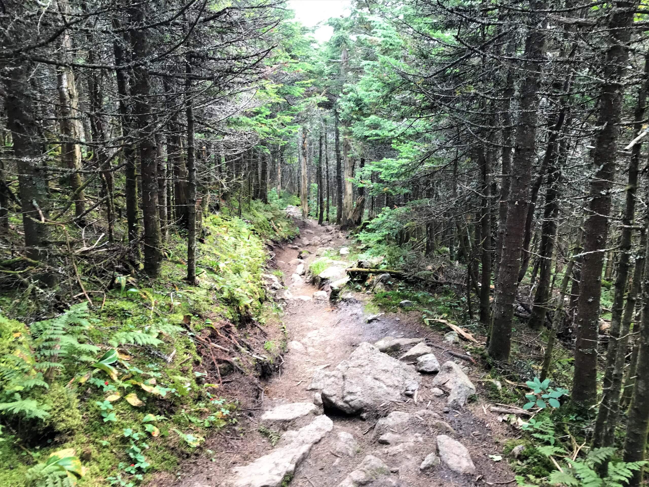
From there you will head towards Mount Adams along a relatively flat section of the Appalachian trail. Pay attention here, there is another trailing that leads in a slightly different direction and takes an exhausting boulder field up to the summit of Mount Adams.
Between Mount Adams and Mount Washington, it is possible to just hike along the Appalachian trail, but you will miss summiting some of the mountains, which are each on short side trails of their own (this will extend your hike beyond 19 miles, so keep this in mind).
Once you leave Mount Washington, you will hike through Crawford Path, the oldest continuously maintained footpath in the US, and passing a large boulder field to reach the Lake of the Clouds Hut (44.258831, -71.318817). This is the highest and most visited of the AMC huts and is considered a bucket list destination (and I highly recommend staying here).
The Mizpah Spring Hut is also located a short distance from the Crawford Path, nestled between two 4,000-ft peaks. Though it is 2.6-miles from the trailhead it boasts large, south-facing windows, smaller bunkrooms and a library.
The Gear
Packing tips
The weather on this trail is some of the most unpredictable weather in North America, with the highest wind speeds ever recorded in the country. You can get a snowstorm in the middle of the summer, high winds, and a thunderstorm can roll in faster than you can scramble to the nearest hut. So bad weather can be more than just bad weather here, it can be downright dangerous.
Therefore, being prepared is an understatement. Some of the things I recommend you have in your pack include:
- Hat and mittens
- Rain gear
- Sun Protection
- Whistle
- Compass and maps
- First aid kit
- Trekking poles
- Phone charger (and make sure your phone is charged before heading out in case of emergency)
- Headlamp
- Tent (depending on if you are camping or staying at one of AMC’s huts)
- water bottles
- sleeping bag
- Good, well broken in shoes
- Food
The Challenge
Training plan
This hike is no joke. With elevation gains totaling around 9,000-ft and some seriously rugged terrain, you need to be relatively fit to complete this trek. No one should take this trek lightly; it can end in injury or worse. Being prepared and knowing what your body is capable of is key.
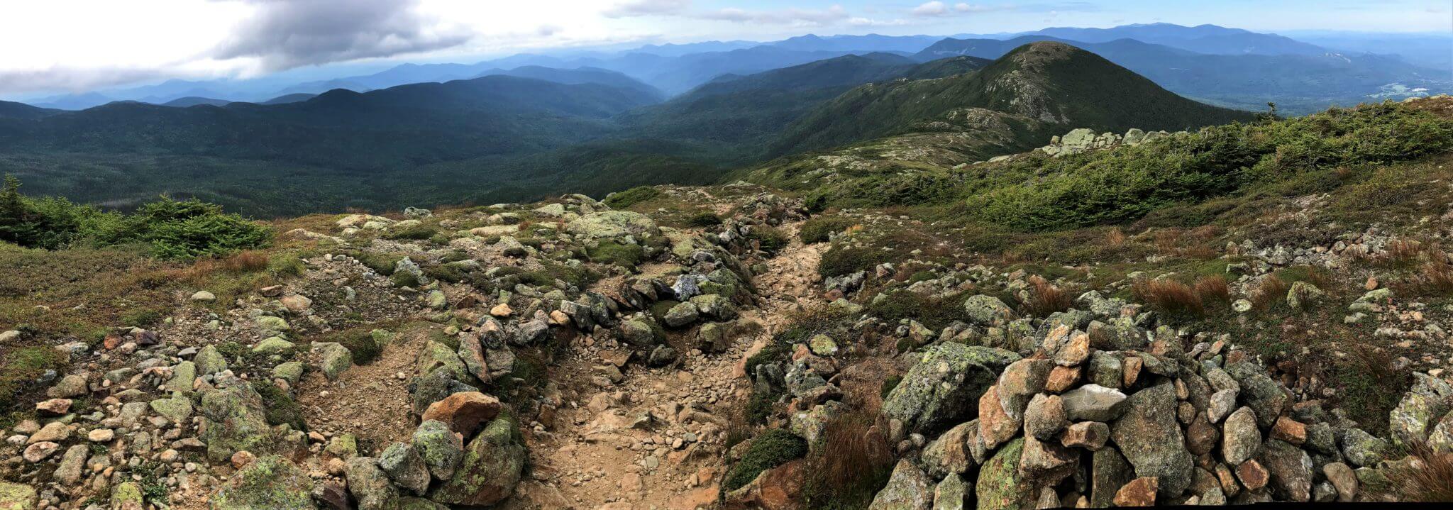
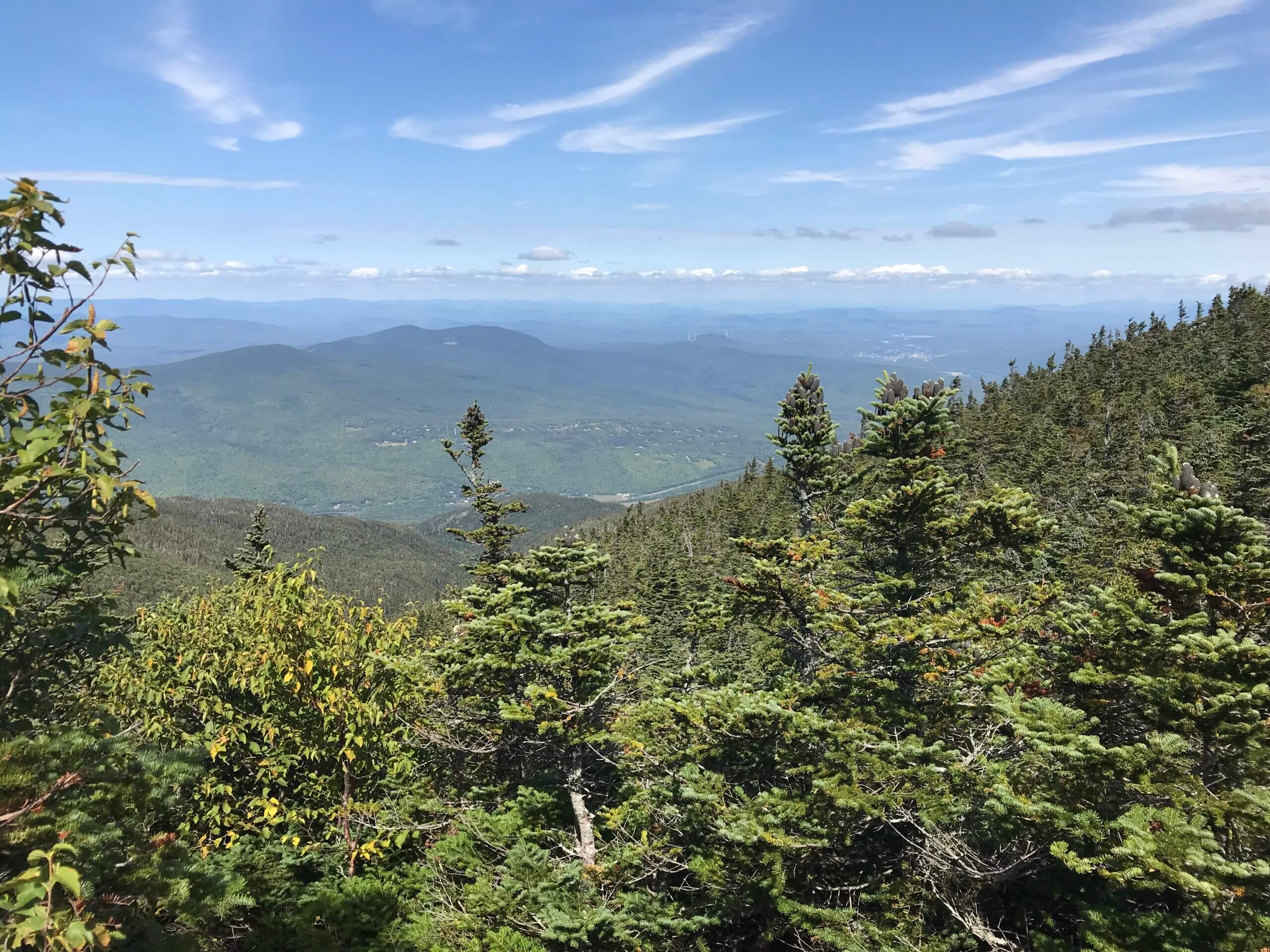
If you are uncertain of your ability to complete this trail, one recommendation is to hike the Franconia Ridge Loop. It is a 9-mile trek over Mount Lincoln, Mount Lafayette and Little Haystack. This will provide some similar challenges to the presidential traverse giving you an idea of the challenge ahead. It is also said to have the most beautiful views in the entire White Mountain range.
During my trek of the Franconia Ridge Loop, I ended up socked into a cloud near the top and had zero views, so I can’t tell you if the views truly are what people say. But there are really beautiful waterfalls along the way and, yeah, it’s a tough hike.
Hiking Itinerary
So, there are many options for doing this. Some people complete the 20+ mile trek in one day, some do it over multiple days. The challenge, of course, is to complete the trek in one day.
I really wanted to do it in one day, but I am really glad I didn’t because 1) I wouldn’t have made it and 2) it’s such a great trek that I am so glad I got to enjoy the scenery and experience the AMC huts even if it was just briefly. If I were to do it over again, I would have done it in 2 nights and 3 days at a minimum.
I don’t think there is any wrong way to go about it. You should always hike your own hike, whatever that looks like for you. Regardless of your choice, it’s going to be difficult. But with some of the most stunning scenery on the East Coast, no matter your choice, it’s one of the best hikes you can choose.
Concluding Thoughts
The Presidential Traverse trail is considered on the most stunning hikes in the White Mountains of New Hampshire. The other, as I mentioned above, is the Franconia Notch trail, which you can definitely do in a day. So, if you are strapped for time but want to check out a great hike, check out my guide to hiking the Franconia Notch.