*This post contains affiliate links, if you click a link I make a small commission and you help support the blog
Hiking the Presidential Traverse Trail, in New Hampshire’s White Mountain National Forest, on the east coast of the United States, is a bucket list item for many hikers. It was my first solo multi-day hiking trip and one of the hardest trails I have ever done.
For whatever reason I had a really hard time writing this post. I struggled mightily on this trail and quite honestly, I was a bit embarrassed about just how much I struggled. But let’s not start there. Let’s start with what this trail actually is. The logistics. Then we will talk about me.
What is the Presidential Traverse Trail?
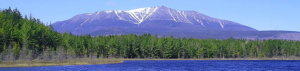
The presidential range is located in the White Mountains of New Hampshire. It consists of the highest peaks of the White Mountains (with the summit of Washington being the highest peak) named after various former presidents and prominent public figures from the 18th and 19th century. It’s a 19-mile trek that including 13 mountains, 9 of which are above 4,000 feet, so expect some significant feet of elevation gain.
What mountains make up the Presidential Range?
- Mount Madison (5,367-ft)
- Mount Adams (5,774-ft)
- Mount Clay (5,533-ft)
- Mount Eisenhower (4,780-ft)
- Mount Franklin (5,003-ft)
- Mount Jackson (4,052-ft)
- Mount Jefferson (5,712-ft)
- Mount Monroe (5,384-ft)
- Mount Pierce (4,310-ft)
- Mount Quincy Adams (5,774-ft)
- Mount Sam Adams (5,774-ft)
- Mount Washington (6,288-ft)
- Mount Webster (3,911-ft)
How long does it take to hike the Presidential Traverse Trail?
The entire trek can be done in several ways. Some have completed the entire 19-mile trek in 1 day. You can do it in two (my trek), though most complete the trek over 3 days making it significantly more manageable and less rushed.
If you do it over 3 days, you can summit all the peaks and take your time. Less than 3 days you have to start making decisions on which summits to skip because each requires you taking a loop trail, making it a longer trek. You can’t just hang out at a peak and enjoy the immense beauty of the Whites.
Less than 3 days becomes a race against time. You need to make it to your planned stopping point, whether that’s a hut or the end of the trail, or you’re going to be hiking in the dark. Realistically, if you hike over 1 or 2 days you will spend some time hiking in the dark so make sure you get an early start.
How hard is the Presidential Traverse Trail?
This trail is no joke. Many recommend starting at the Appalachia trailhead, hiking the Valley Way trail up and heading south. This way you start with fresh legs for the hardest section of the trail. It is extremely rocky terrain, so be careful where you step, a rolled ankle will make for a difficult descent off the trail.
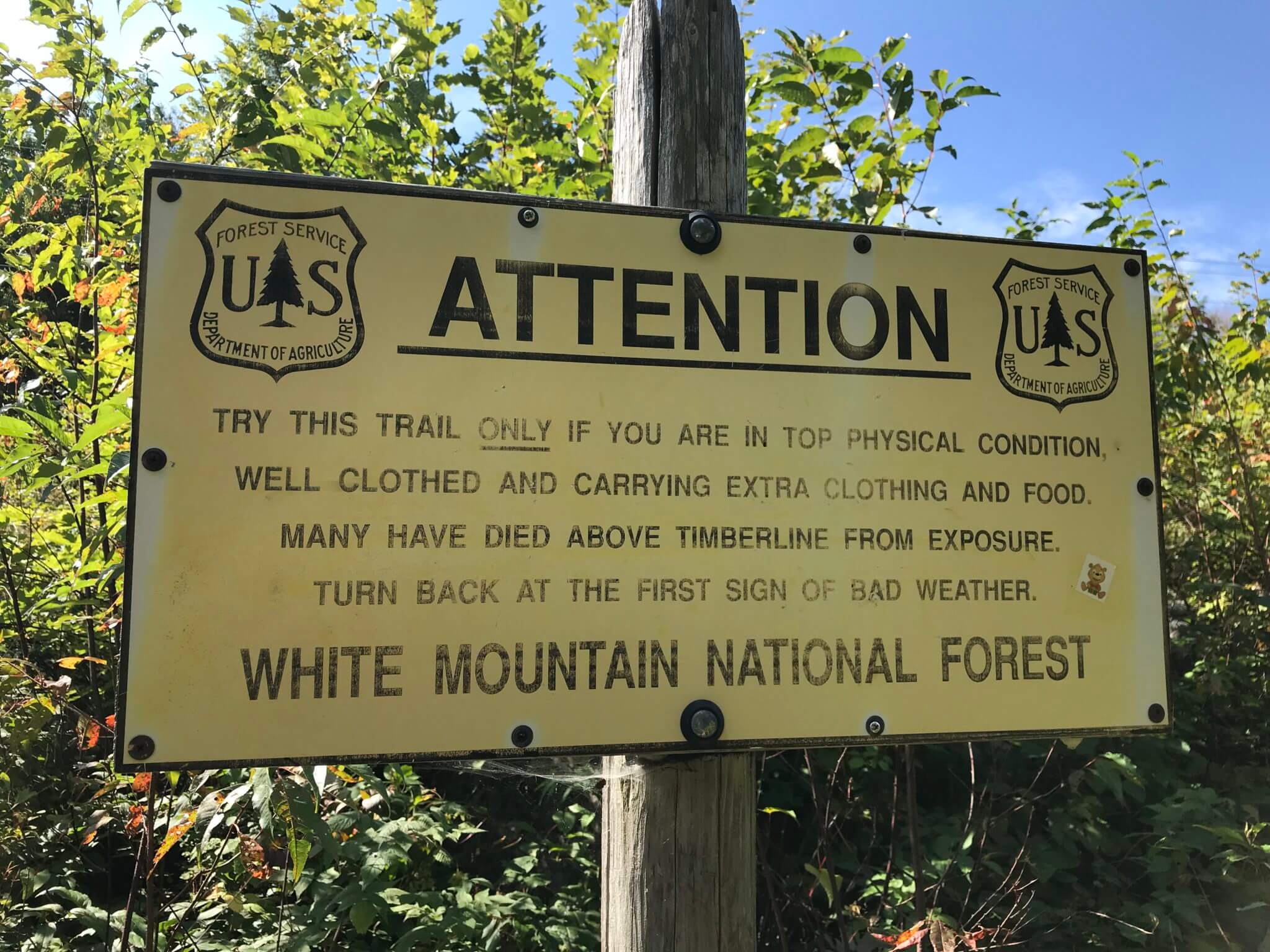
Make sure to check the weather conditions multiple times before you head out. Getting stuck in bad weather on these mountains can be very dangerous. They have some of the highest wind speeds recorded in the US.
When I was preparing for this trek, no one really talked about just how hard this trail is. I consider myself fairly fit. I run regularly and I work out at the gym several times a week. There were times on this trail I wanted to quit it was so hard. But I’m too stubborn for that. My first realization that this was going to be a challenge was when I had to make the decision to skip the summit of Madison in order to have enough time to get to my hut and then I took the hardest route possible from the Madison Spring hut, instead of the nice flat Appalachian trail that I somehow missed.
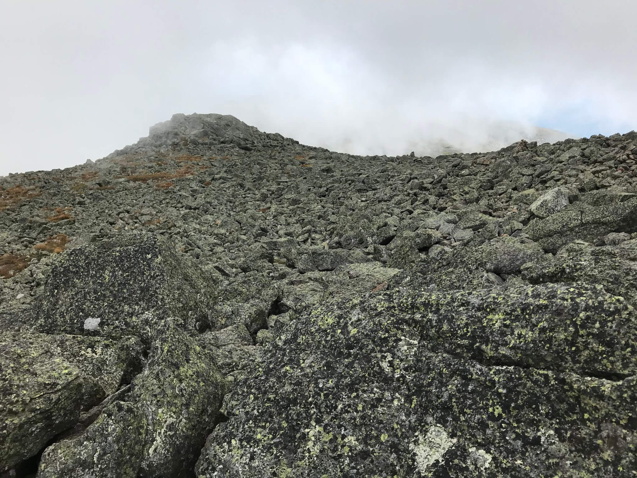
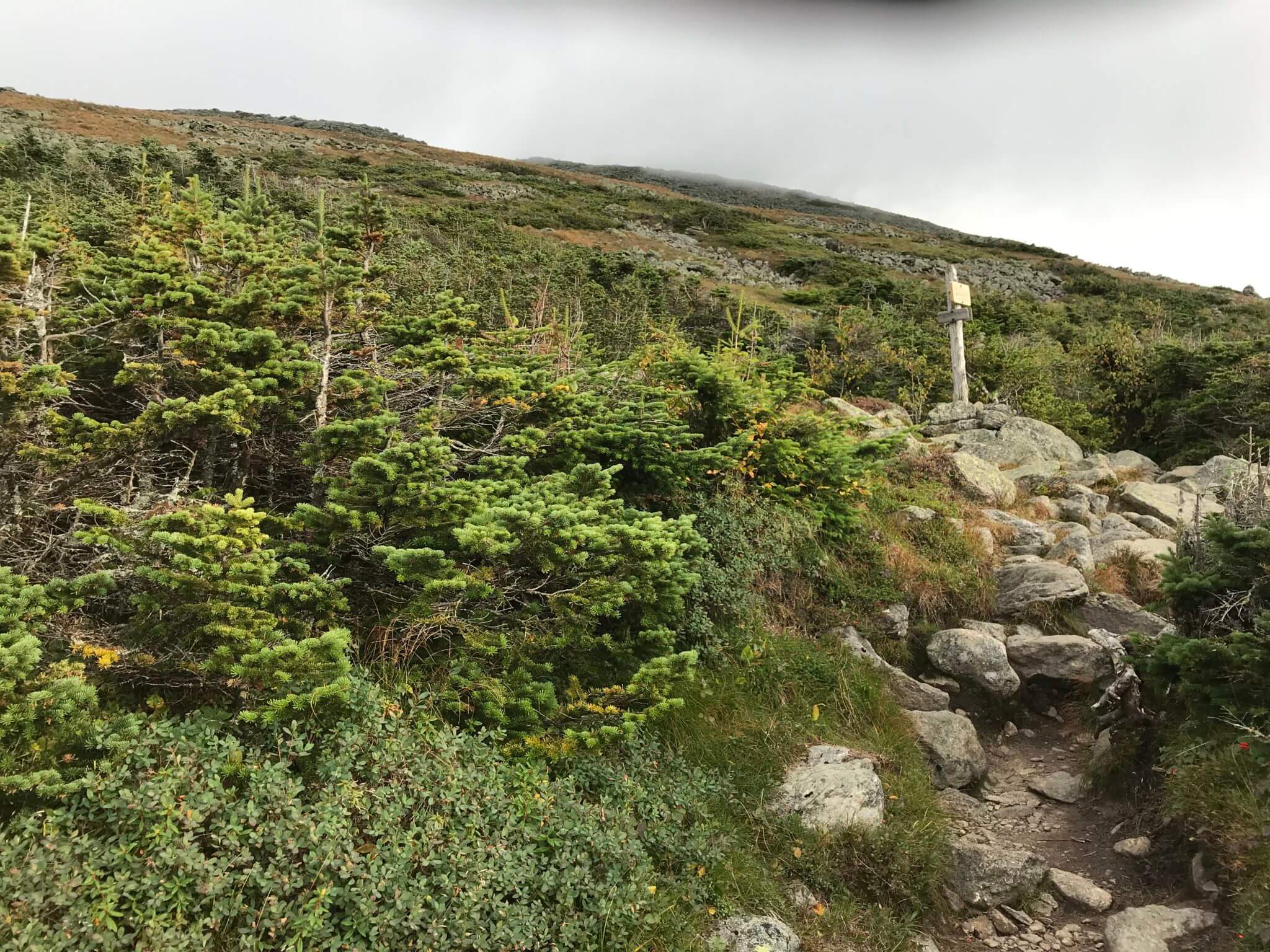
The sign above is at the start of the Valley Way trail warning people of the difficulty of the presidential traverse. It’s not kidding. The entire first half of the trail is mostly made up of rocks. It’s extremely slow going and hard on your feet. For me the rocks are what make it so challenging.
If the trail was just steep but relatively easy walking, it wouldn’t have been that big of a deal. However, the majority of the trail is rock and bouldering. I love climbing rocks but it got old real fast.
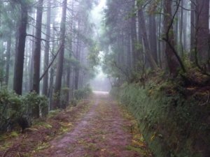
The second half of the trail, from the Lake of the Clouds Hut to the Mizpah hut at least is significantly easier. On this section you will see lots of day hikers and trail runners. On the section from the Valley Way trail to the Lake of the Clouds hut don’t expect to see many people.
How to Prepare for the Presidential Traverse
The most important thing to keep in mind is ensuring you have enough food, water bottles and clothing layers to protect you in the event that you have to overnight on the trail. For a more detailed account see how to prepare for the Presidential Traverse Trail.
Huts and Camps
If you decide to do that multi-day trek, which I highly encourage, you have several options. You can break up your hike according to the Appalachian Mountain Club huts, which I also highly recommend. Or, if you don’t want to shell out that much money (they are around $145 a night), there are several camping options along the way, just be aware that you must camp below the tree line due to the sensitive plant life at higher elevations.
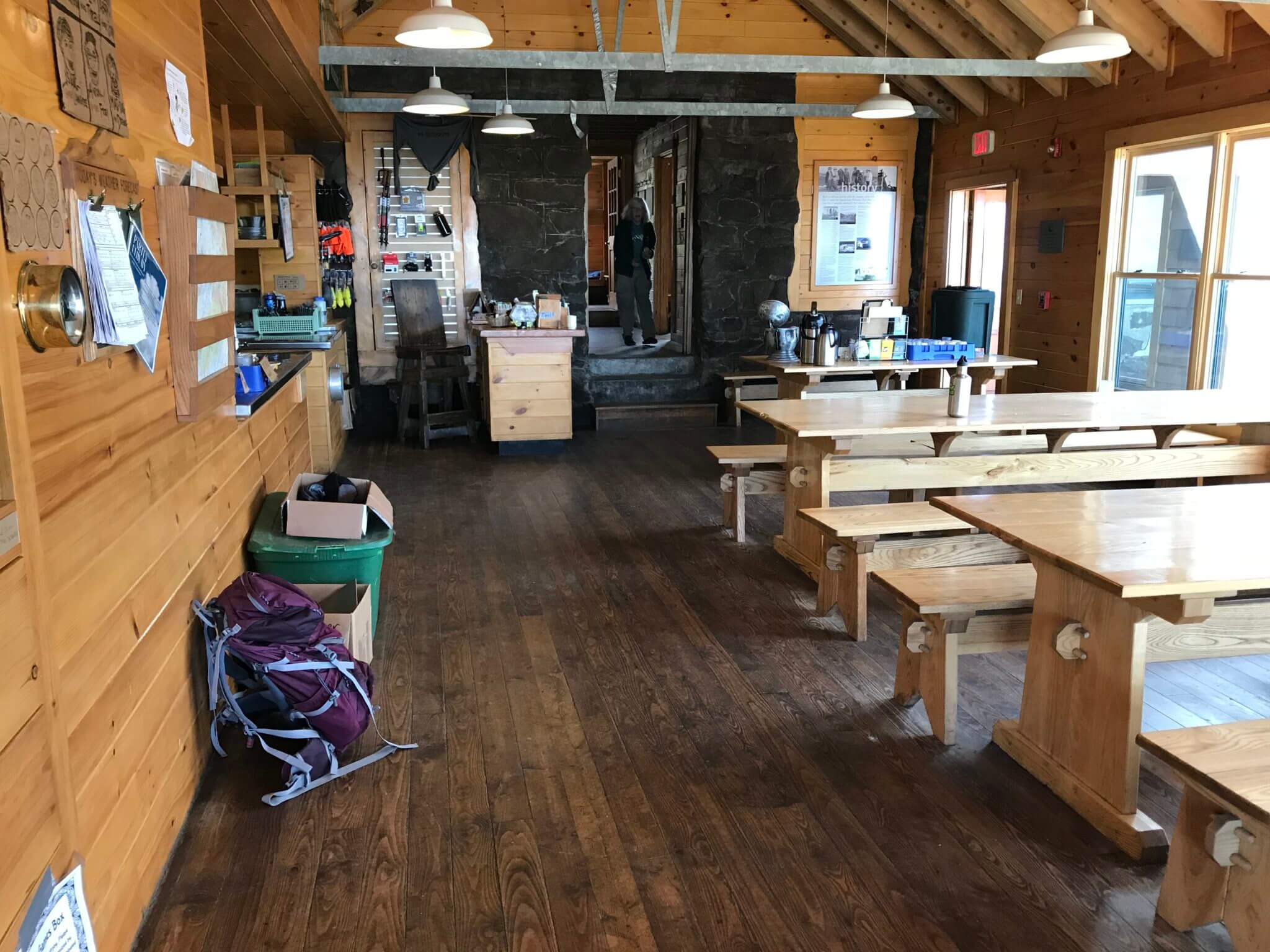
The AMC huts include the Madison spring hut, Lakes of the clouds hut (this is where I stayed), and the Mizpah spring hut.
The huts, I would argue, make life a little easier. You don’t have to carry as much food, you are given 2 meals during your stay, you get up-to-date forecasts (probably the most important thing to monitor), and you get to meet a lot of great people.
The Trail – My Story
Day 1
I decided to attempt this hike over 2 days. Before I started really planning this trek, I thought I would be able to do it in one day. That was the challenge, and I was amped up over the possibly of doing the challenge. Something that would push me physically and mentally and be something that not many others had achieved. That was my ego talking.
Let’s just say I was talked out of doing it over one day and settled on 2. This was mostly because I really wanted to stay at the Lake of the Clouds hut, which is a really good place to stay and another bucket list item for many hikers.
I arrived in Gorham, New Hampshire the night before the start of my hike. A cute little town, with easy access to the White Mountains. As I packed up my gear the next morning, I felt the anxiety coursing through my entire body.
This nervous energy was all based on which parking lot I would park my car and making it to my shuttle on time. I parked just off the side of the road next to the Highland Center at Crawford Notch. The AMC shuttle picks up hikers from the Center multiple times a day. At around $25 they will drop you off at the trailhead. The earliest shuttle is at 9 AM, putting you at the base of the Valley Way trail at 10:05 AM. This was my first mistake.
Once on the shuttle, I met a lot of great people, some of which I met up with several times along the trek. But once you step foot on the trail, it’s all on you. Reaching our own paces, we began to thin out.
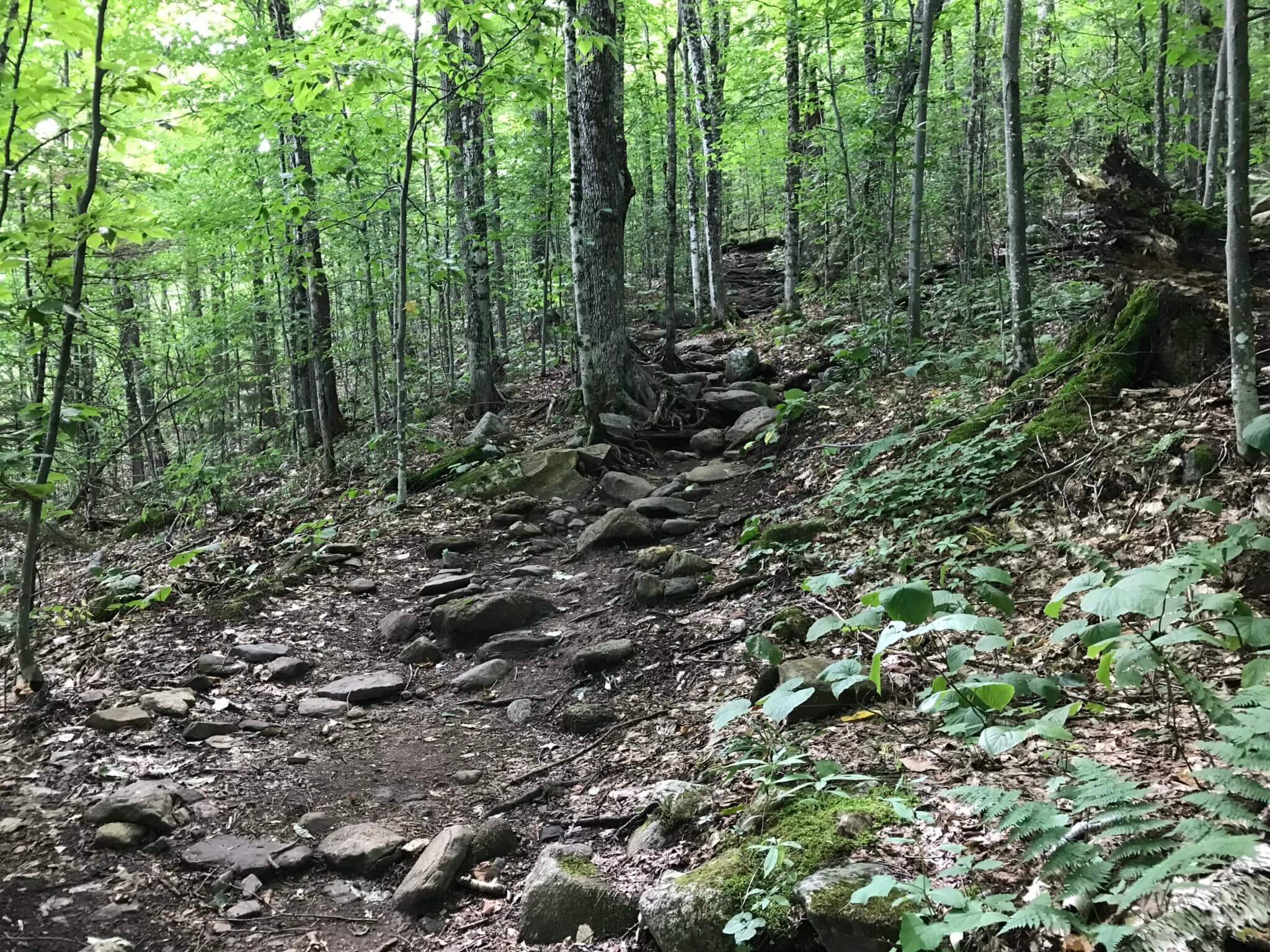
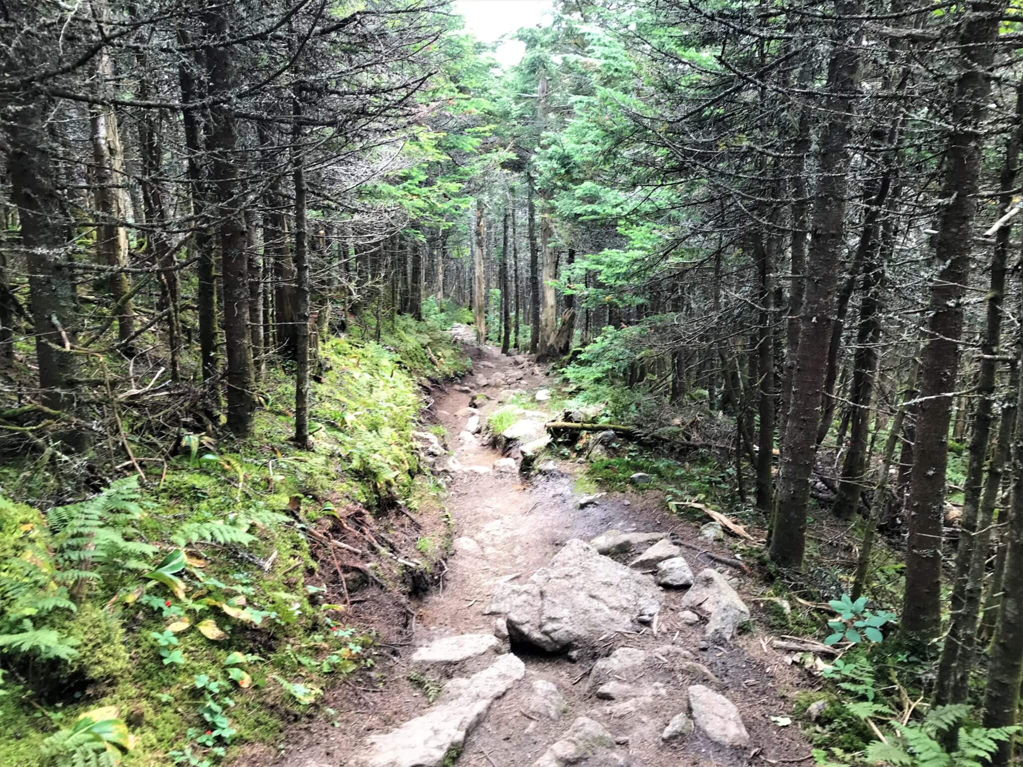
Your first day starts at the Valley Way trail, which is an approximately 3- 3 ½ mile trek up 4,500-ft. It’s steep but it’s through the cool enclosed forest. Until you reach the alpine region you feel like you are just taking a nice hike in the woods.
As the air starts to get thinner the incline becomes more challenging. My pace slowed down, but I still felt good. The first place you reach is the Mount Madison hut. You can buy a lemonade and small coffee cake while you take in the views.
I was excited and happy. I had reached the higher elevations. This is where, if you are doing this trek over a shorter time frame, you need to make some decisions. Mount Madison was in the opposite direction of where I was headed. I had to skip it.
From the Mount Madison hut, you have several trail options. There is the Spring Lake trail or the continuation of the Appalachian Trail. Mistakenly, I took the Spring Lake Trail, thinking I was continuing on the AT. I should have looked more closely at my map.
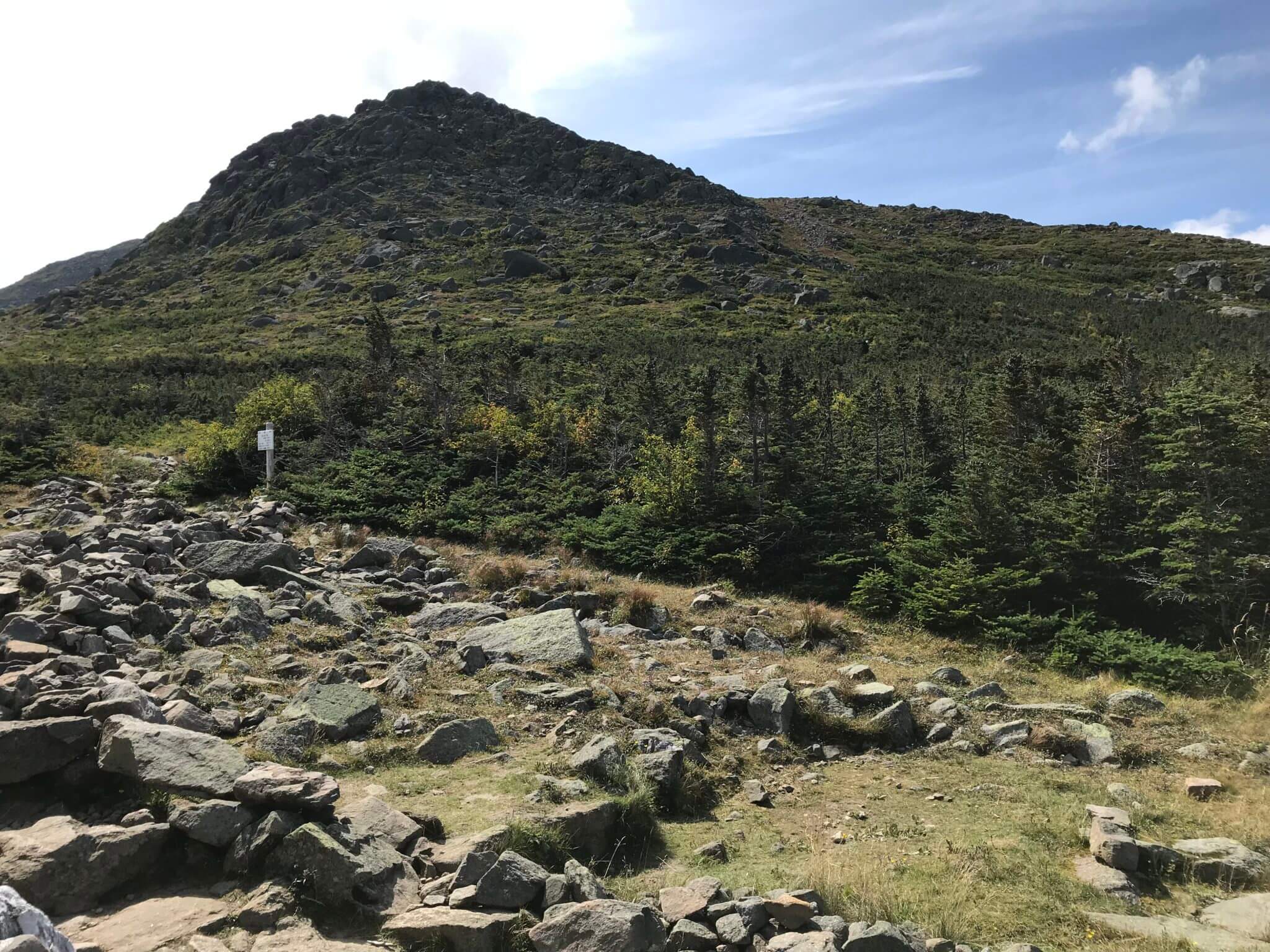
Adding another 1,000-ft in elevation I clamored hand over hand up Mount Adams. It was a boulder field the entire way up. That’s when the swearing started. I gazed in absolute wonder at the gaps in the boulders and the precariously placed rocks that could easily spell my demise.
The only thoughts running through my head were “I could die here” and “Fucking Rocks.” I learned later that particular section of the AT was extremely easy walking and beautifully flat, which certainly didn’t help my mood.
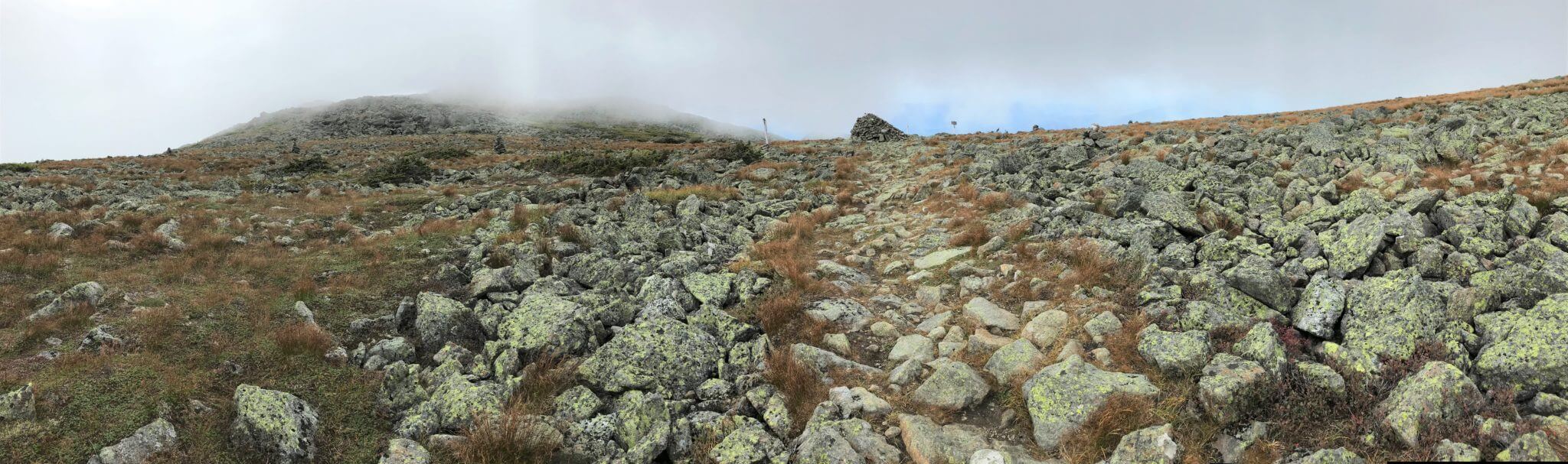
But I summited Mount Adams and carried on to thunderstorm junction. It was all rocks. There was not a flat area to be had. In the distance I could see Mount Washington, shrouded in thick cloud and I thought with absolute glee, “Well that’s not that far away. And the hut is just beyond that.” What a sucker.
The winds began to pick up the closer I got to Mount Washington. It was cold. I took off my pack in a sheltered area along the trail and pulled on my hat and mittens, eating some slightly frozen granola bars and beer jerky while I was at it. My feet hurt and so did my shoulders.
Though I contemplated quitting many times over the course of the day, I knew I never would. All I could was keep putting one foot in front of the other. There was no plan B.
I continued to sink down into an abysmal mood with thoughts of complete awe at AT thru-hikers, quitting, and the unbearable pain in my feet from the constant onslaught of rocks. My ego was putting me in this low mood. I mean what was I thinking? Who did I think I was attempting this?
But my mantra became “everyone has to hike their own hike, no matter what that looks like.” It could be running, cool and confident along the trail or it could be at a sloth’s pace. Everyone has to hike their own hike and forget what other’s might think or what others have done before you. That doesn’t matter.
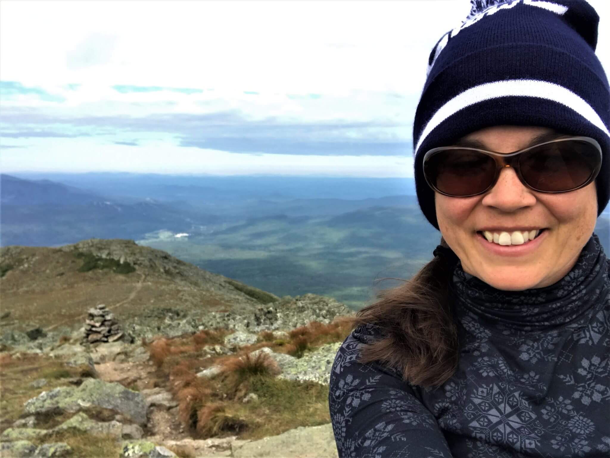
We are not all the same and neither are our hikes. I approached Mount Washington thinking that I would get up there, buy myself a Snapple and then head to the hut. By that time, I knew I wasn’t going to make dinner at the hut.
But the closer I got to the summit of Mount Washington the colder, darker and windier it became. The entire mountain was enclosed in a thick cloud. There would be no summit views. Was it really worth it? Then, I reached a junction in the trail that lead either to the Lake of the Clouds hut or the summit. I chose the hut.
I had almost nothing left. But I could see the hut in the distance. It was so cold and windy out there and the light was quickly disappearing but I didn’t want to get out my headlamp because that would mean taking off my pack. And that was too much work.
I kept envisioning myself hunkering down on the side of the mountain for the night, with the glow of the hut just beyond my reach. Pushing those thoughts aside and swearing fiercely at the rocks and on the verge of a total meltdown, I continued just putting one foot in front of the other, vowing to make it to the hut.
Just after 9 PM, in total darkness, I finally reached the door to the hut. It was teaming with people and the crew, with their smiling faces, brought me food and set me up with a bunk.
I had made it. Overjoyed, slightly delirious and totally exhausted but I made it. I had hiked my own hike forgetting what others might think about what I summited and what I didn’t. All I wanted was food and sleep and to get that damn pack off my aching shoulders. Those things made all the difference and bolstered by that I set off on the second part of my journey, optimistic about the day.
Looking back, I am pretty proud of what I accomplished that day, even though I still have this nagging in the back of my mind that I didn’t do it all. I missed a couple of peaks. But I had hiked the Presidential Traverse Trail, no matter what others thought. It was hard but I pushed through and did it and no one can take that away from me.
Maybe one day I will go back and take my time and summit all the peaks. No rushing. No adrenaline pumping “challenge.” Just me and the mountains. It’s a nice thought.
Day 2
After a good night’s rest, food and storytelling among new friends, I felt ready for the next part of my trek on the presidential traverse trail.
I had read on multiple blogs that it is best to do the traverse trail from north to south, because the northern half is significantly more difficult. This way you do the worst, or hardest, section of trail with fresh legs.
Well, I agree with the fact that the northern section is the hardest. As I set out from the Lake of the Clouds Hut (elevation: 5,012 ft) on Day 2, I was optimistic. And for good reason. I had spent time pouring over my map and I headed out the door with a plan.
However, I still went the wrong direction. As I started up the trail, I felt like I was heading back towards Mount Washington. Stopping a couple of hikers just leaving the hut, my feeling was justified. I was indeed headed back the way I came.
The good news was that I had not really gone very far before I realized this.
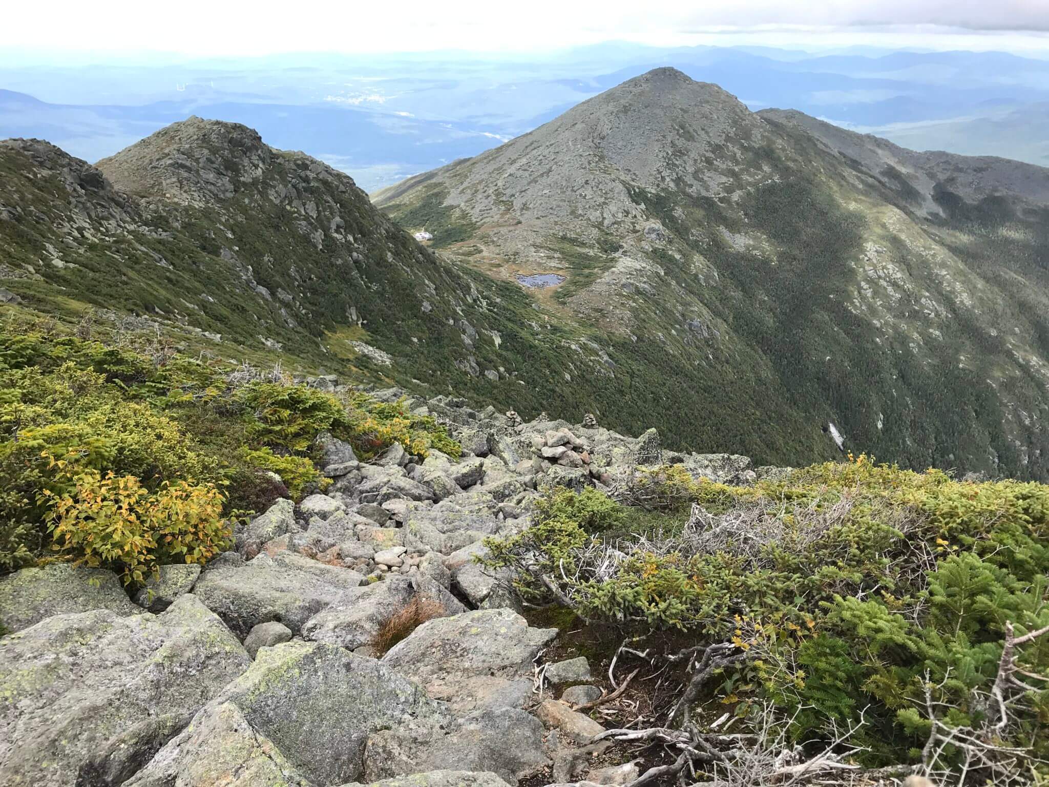
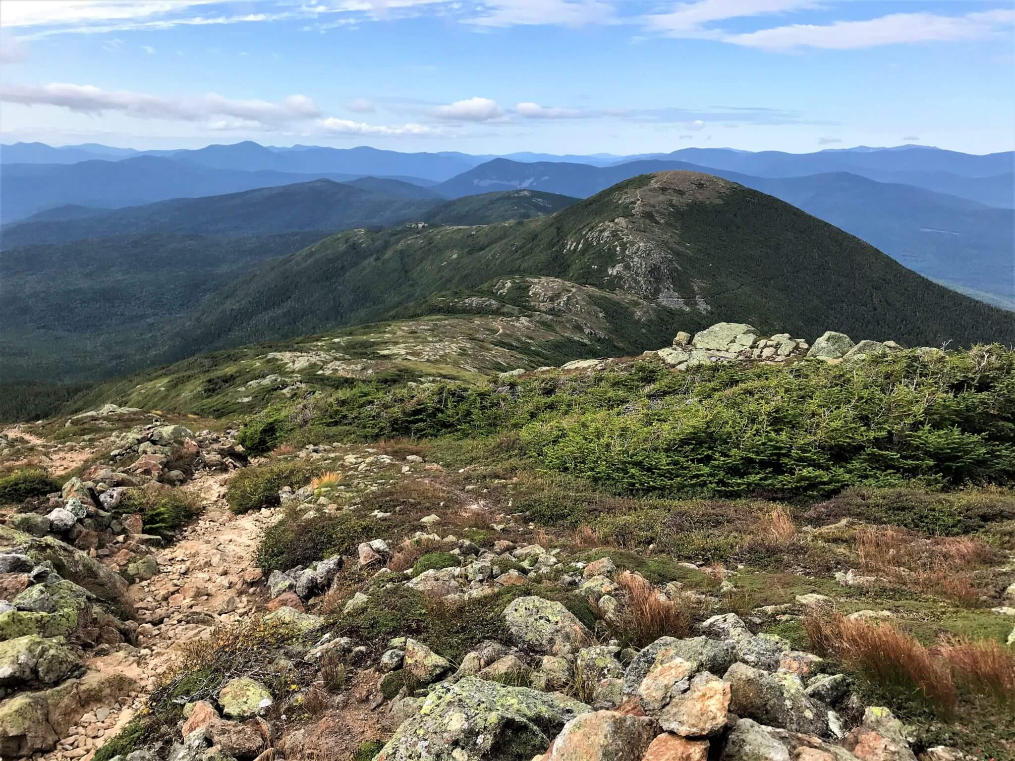
Once I found the right trail, the rest was pretty smooth sailing. Taking the loop trail to summit the first peak of the day, Mount Monroe (elevation: 5,372 ft), my confidence was bolstered.
It was a good start. The views on top of Mount Monroe breathtaking and it was the start of the section of the presidential traverse trail with the best views.
This section of trail is significantly less rocky, giving you the opportunity to take in the views and actually enjoy yourself a little. It’s also a pretty fast section because it is flatter.
Mount Eisenhower is the second peak (elevation: 4,760 ft) after Monroe. Following the loop trail up a steep set of switchbacks the summit is capped with a huge cairn, right in the middle. The views continue to get more and more spectacular here.
All around you are the White Mountains, with their peaks jutting up into the sky. I couldn’t help imagining them covered in snow during the winter months and just how majestic they must look.
The day itself couldn’t have been better, with just a slight breeze and temperatures in the upper 30s low 40s. I literally could have stayed there all day. I know my feet and shoulders would have been happy.
The trek from Eisenhower to the next peak, Mount Pierce, feels like it is a longer section that weaves in and out of the alpine region. Truth be told, however, the hike from Mount Monroe to Eisenhower is the same distance as that from Eisenhower to Pierce.
I saw several day hikers and trail runners over the course of this day. Having seen no one except multiday hikers on day 1, this is indication enough just how much easier this section of trail is.
It’s still no joke, don’t get me wrong, but after what I had been through the day before, this was a walk in the park.
The alpine sections of trail were also significantly more wet and there are multiple manmade wooden trails above these areas. One final section brings you to a crossroads. Continuing on will take you down to the Highland Center at Crawford Notch and the end of your journey.
A very short ascent up will take you to the summit of Mount Pierce (elevation: 4,312 ft). As a “last summit” for me, it was a bit underwhelming. Especially after the incredible majesty of the mountain views from Monroe and Eisenhower.
From Pierce you can continue on to the Mizpah Hut (0.8 miles) and beyond that Mount Jackson (1.6 miles from hut to summit). Or from Mizpah there is a side trail (Mizpah cutoff) that joins up with the Crawford Path taking you out to the Highland Center at Crawford Notch.
After talking with the crew at the Lake of the Clouds Hut, I decided to summit Pierce and then back track to the crossroads and take the Crawford Path out. The crew said that this trail was particularly beautiful and a great way to end your hike. They also said that Mount Jackson (elevation: 4,052ft) was the hardest hike they have ever done.
By the time I reached the summit of Pierce my feet and shoulders had had enough. It was time to slowly pick my way off the trail. Others continued on to Mizpah, for lemonade and a snack but my hike was done.
The hike out felt like it took forever and that I was never going to reach the end. I had returned to sloth mode, angry at the constant assault of rocks returning. My feet and shoulders screaming as I picked my way over rocks descending down into the coolness of the forest.
I took a lot of breaks. It was all I could to keep going. The trail was spectacularly beautiful and the crew was right, it was a good choice, if your feet can handle it.
Eventually the trail dumped me out onto the road and I slowly hobbled my way to my waiting car. I was sore and tired but I had made it.
Over the course of my hike I kept telling myself that everyone has to hike their own hike. That is didn’t matter how fast or slow I was. It wasn’t a competition. No one was going to be disappointed in me. This was my hike. It was up to me how I did it.
Concluding Thoughts
Looking back, I am extremely proud of what I accomplished. Yes, I missed some of the summits, from poor planning on my part. Yes, you could definitely get the most of the trail if you do it in 3 days. But I am happy with what I achieved.
I don’t know if I will ever go back and do it again. Maybe one day I will want to try the more relaxed 3 days trek but for now my hike is done and I can look back with a sense of pride at my achievement. Something I did by myself, going on my own strength. And I’m good with that.
To start planning your hike, check out my post on “How to Prepare for the Presidential Traverse.”

Comments
I did the hike in a day sometime in July 2023. It took me 16 hours which was 6 hours more than I was expecting. Is is one of the most memorable and rewarding hikes I ever did.
Nothing I read or pictures I saw would have prepared my for the strenuous and rough nature of this trail. It was 16 hours of rock hopping straight up and down 90% of the time.
I have been leaving this comment ever so often as a note to would be first time hikers in the White Mountains. Expect to do half your usual daily miles. The strenuous nature of the trail and the under foot conditions means that you have to slow down for safety. Prepare to sub freezing temperatures and prepare to be stranded for a day or two. So carry some type of shelter, enough food and water, warm clothing and a decent sleeping bag. You should do this even on a day hike. It is not by chance that you see weekly rescues in the White Mountains.
After Valley Way trail, then Mt Madison and back to Madison Spring Hut, I though I had enough. Just 4.5 miles in. My legs were shaking so hard from fatigue another hiker filling up with water in the hut noticed and invited me to sit down for a minute or two. This was my introduction. At this point I understood what none of the pictures or reviews would have prepared me for. I don’t think I saw much of the scenery after this point in my hike, at least I did not take many pictures of it. It was just a slow focus on every step because the 1 day weather window I had meant that I had to finish the trail in a day or abandon the hike. I dreaded going back down the Valley Way trail so I continued on, but more slowly, endlessly rock hopping up to Mt Adams and beyond.
A few weeks after my hike a 21 year old had a medical emergency somewhere on the other side of Madison from Valley way. There could be no rescue because temps were in the 20s and wind gust in excess of 90 miles per hour were recorded on Mt Madison. Remember this is in the middle of the summer. Rescue could not be attempted for more than hours. Endless CPR from friends and other hikers failed to save the persons life.
Again, this really is my general warning to would we White Mountain hikers from outside of New Hampshire who are first time on these trails. They are way tougher than you would expect in your wildest dream or nightmare. Slow down, thread carefully, pack for contingencies, cold, a busted ankle, bad weather and over night. Heed the warning signs regarding weather.
Author
I completely agree, it was the hardest trek I had done to date and it is not something to take lightly. Thank you for sharing your experience, I think it’s really important for readers to understand this.
it’s like you were in mind when you wrote this blog! just did the traverse in 2 days and i felt every word!!
Great writeup, thank you for taking the time to share & I’m glad to hear your optimism about the entire experience. I’m definitely putting this on my bucket list!
Author
I’m glad you found it helpful and I hope you get the chance to experience it one day.
Thanks for this . To clarify, you went to Gotham in the north, drove down to the south to park, took shuttle north and stated hiking back down? Thanks
Author
Yes, I started in Gorham and drove down to catch the shuttle that would take me north a ways. I just really like the town of Gorham, that’s why I stopped there. It’s also cheaper to stay there than at the highland center hotel, unless of course you plan to camp.