*This post contains affiliate links, if you make a purchase I get a small commission
Huddled alongside Olympic National Park is the Olympic National Forest, arguably just as beautiful as the national park, and a quintessential Pacific Northwest spot. Skip the permits, the crowds and the advanced bookings and head to the national forest, where you can find hiking for everyone, including your four-legged friends.
Getting to Marmot Pass
Marmot Pass, like many of the hiking trails in Washington, can be a bit hard to locate if you have never done so before. There is no easy GPS location you can use, though the Washington Trail Association provides the exact GPS coordinates. They also provide turn by turn direction from Quilcene, WA, which is extremely helpful and I highly recommend using it.
Though the location may feel very remote, the parking lot does fill up, having only 15 spots available. If you are planning to head out there on the weekend, arrive early. There is also a bathroom at the trailhead (though not always smelling the best).
Best time to hike Marmot Pass
In my opinion, one of the best times to go is early spring to early summer, before the main tourist season. It’s quieter during this time and the parking area is small, so it means less competition for spots.
General information
Permits/Passes
You do not need a permit to hike in and around Marmot Pass, but in order to park you do need either a Northwest Forest Pass or an America the Beautiful National Parks Pass.
Is it dog friendly?
Yes! The elevation gain is fairly gentle and easy for most dogs. We took our 11-year-old pooch who is a whopping 25lbs and he didn’t bat an eye and had the best time.
Elevation Gain
The hike up to Marmot Pass has around 3,500 feet of elevation gain from the Marmot pass trailhead. If you summit Buckhorn Mountain (an additional 1-mile past Marmot Pass), you will gain an additional 900 feet.
Highest point: 6,000 feet
Distance
You will reach Camp Mystery at 4.5 miles and the total trek is around 6.25 miles one way (11.5 mile roundtrip hike if you don’t do any of the additional trails found in the area).
Difficulty
Though this is a continuous but gentle elevation gain for the entire trek, it is a difficult one. Once you reach Marmot Pass however, there are some great flat hikes through alpine meadows with phenomenal views.
How much water do you need to carry?
If you are planning to stay for one night in Marmot Pass and there are two of you and a dog, bring at least 5 L of water up with you. You will need enough for everyone to drink, enough to cook and enough for that glorious morning coffee and there are no water sources once you start the final ascent to the pass, so make sure you are prepared.
Guides to help you plan
Mountaineers Club – Day Hiking Olympic Peninsula
Hiking up to Marmot Pass
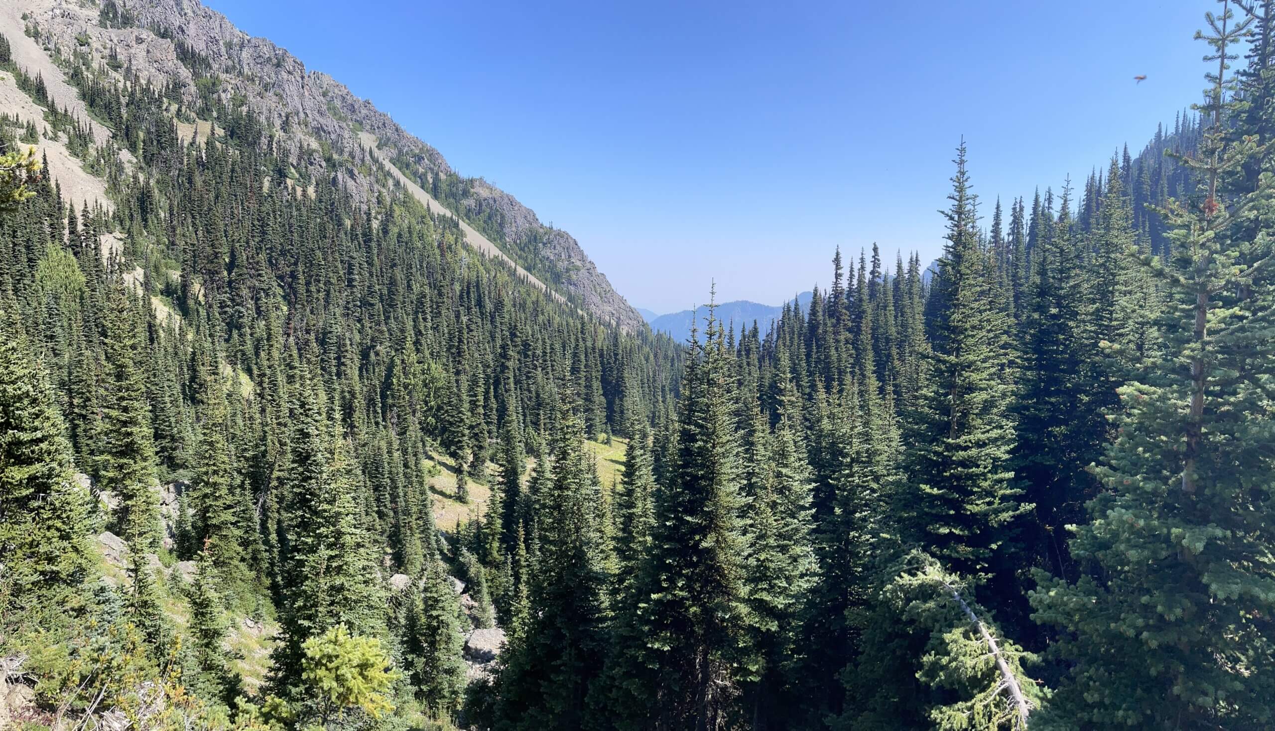
Arriving at the trailhead you’re surrounded by trees standing in a small gravel parking lot. But the moment you step foot on the trail you are engulfed in old-growth forest with large evergreens, walking on a fairly rock free trail. You will stay within the trees for the majority of the trek.
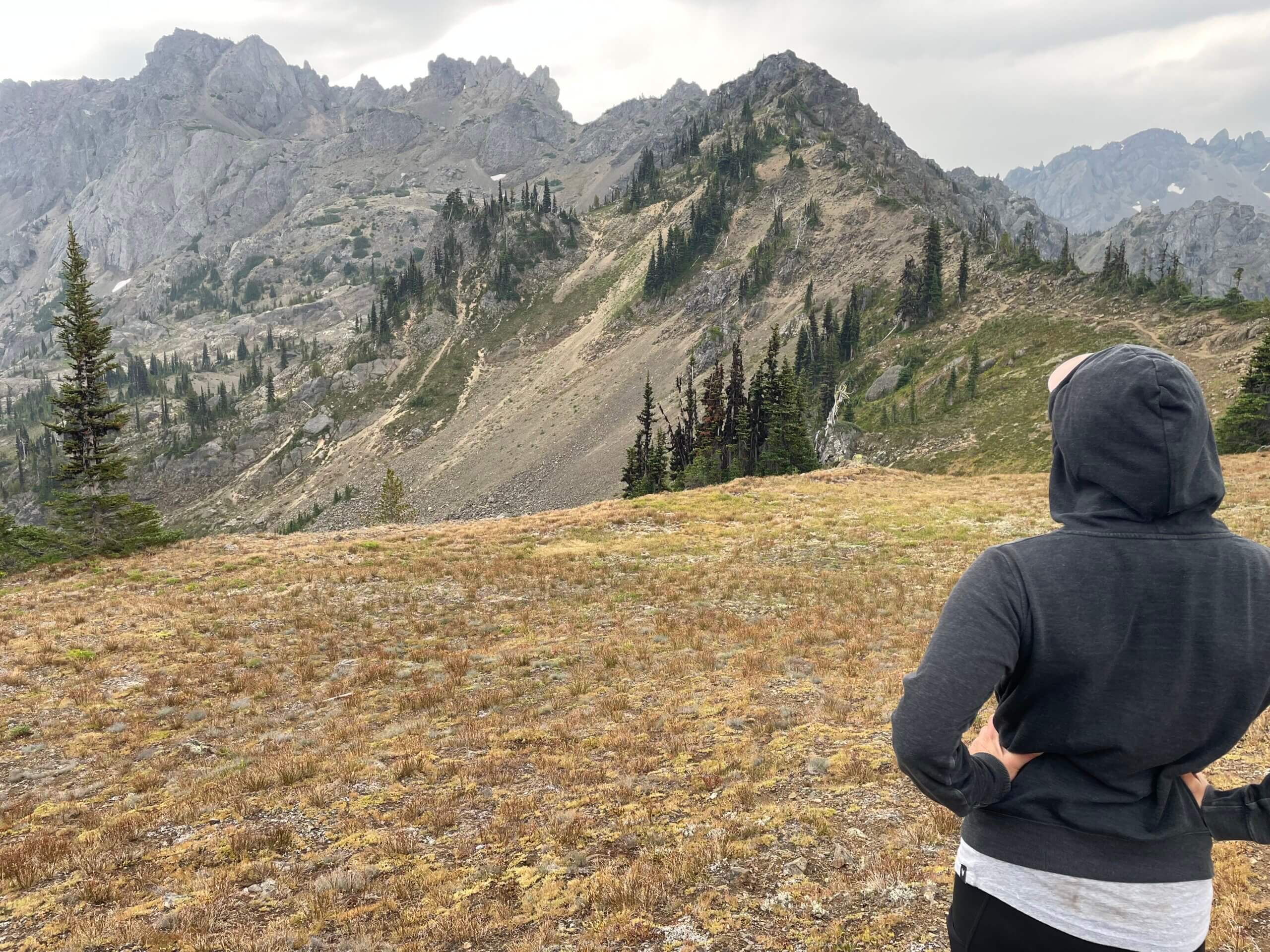
Passing Saddlebrook Camp and continuing on past Mystery Camp, just before Marmot Pass the trail opens up into two sequential alpine meadows and the pass itself. Marmots can be seen here screaming to their friends of potential danger when they see you or your dog coming up the pass.
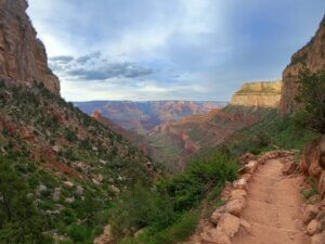
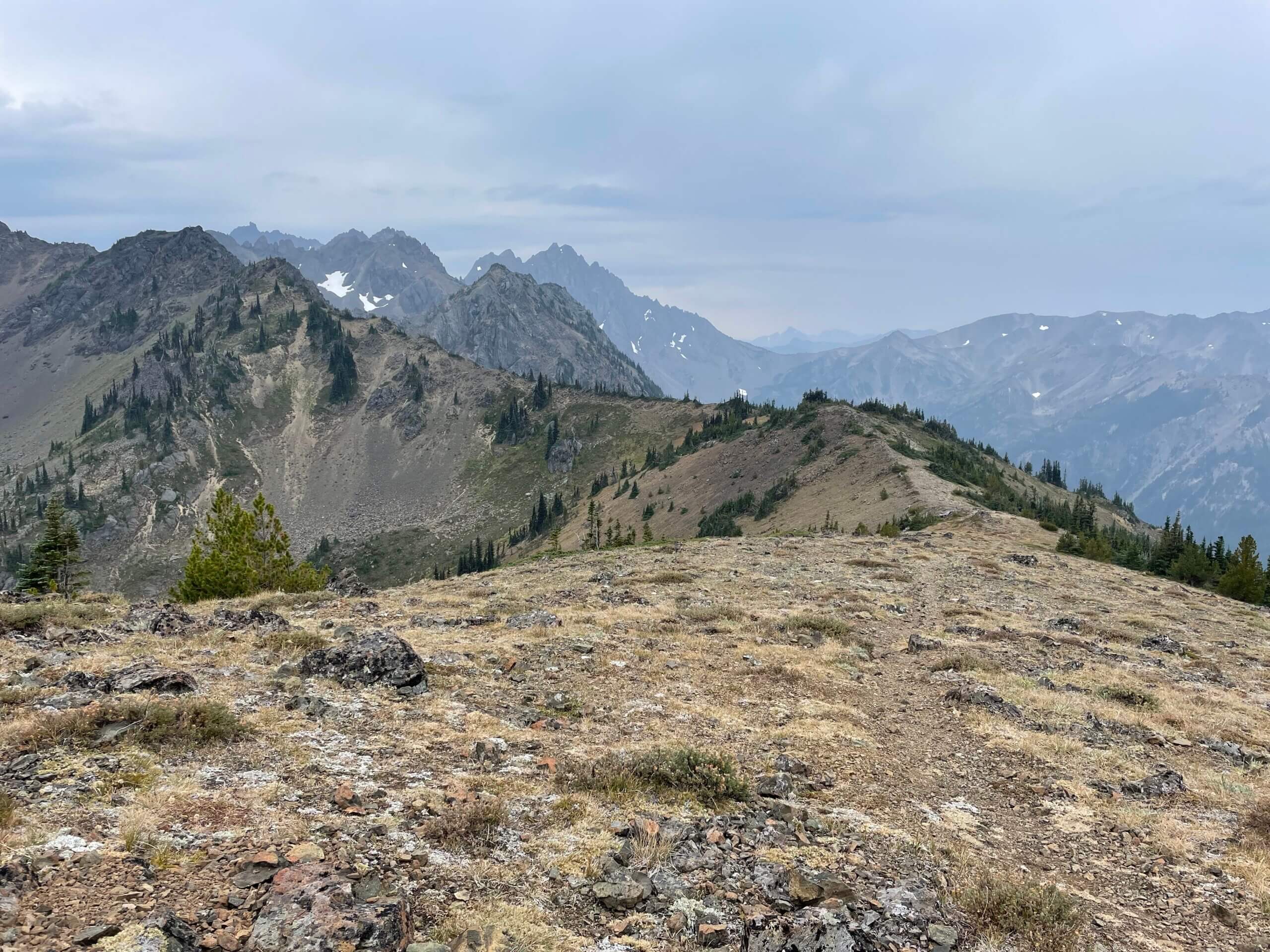
At the top of the pass the trail branches in several directions. Towards Boulder camp an additional 1.7 miles on, towards Buckhorn Mountain along the Tubal Cain trail, and up to some of the most stunning mountain views I have seen in Washington to date. That last trail does not have a name but it is a must see.
Camping
There are several different areas where you can find dispersed camping where there are obvious campsites.
Starting from Shelter Rock Camp at approximately 2.5 miles into the trail, this is a great option if you have arrived late and don’t have the daylight to make it all the way to the pass. There are around 6-8 campsites at this location, some more private than others, all with easy access to water.
Before you reach Marmot Pass, at 4.5 miles in, is Mystery Camp. Another great spot with easy water access. This is a perfect “home base” area, with 6-8 sites available, though all sites are very close to the others so if you are looking for privacy, this is not the place to get it.
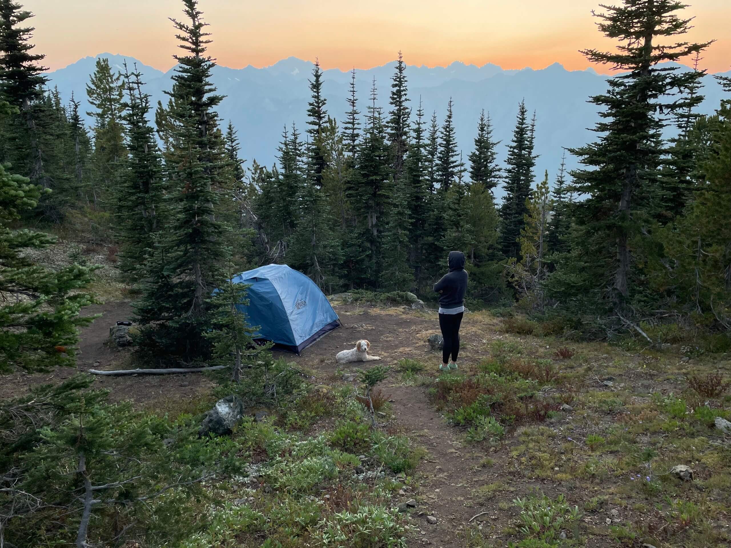
If you are looking for more dispersed camping, with more privacy, head to Marmot Pass. There are several options with great views of the area.
What if there are no campsites left?
With only a few options in the area around Marmot Pass you may find yourself without a spot, especially if you arrive later in the day and on a weekend or holiday. In that case you have a couple options.
There is another camp called Boulder Camp an additional 1.7 miles beyond Marmot Pass or you can head towards Tubal Cain Trail where in an alpine meadow there are dispersed camping spots as well as at Buckhorn Lake. Both of these locations are a bit further along, but they are both beautiful spots with easy access to other trails and also fairly easy hiking.
Be aware, however, that there is no water access at any of these locations except Buckhorn Lake, so pack appropriately.
Hiking beyond Marmot Pass
Buckhorn Mountain
If you are heading to Marmot Pass, you would be missing out if you didn’t hike to the summit of Buckhorn Mountain.
Once you reach the split in the pass, take the Tubal Cain trail on your right. There is a great campsite just to your left when you start down the trail, and is where we set up camp for our stay.
There are two ways to summit Buckhorn Mountain. Not too long after you made that right hand turn at the pass the trail splits in two. The one bearing left continues towards Buckhorn Lake and the one on the right is a short, 1 mile trail up to the summit of Buckhorn Mountain.
This is the more challenging route. It is fairly steep and there is a lot of loose rock and dirt. You will reach a plateau that one could mistake for the summit and is a great place to hang out, but you will need to go on to reach the summit of Buckhorn Mountain. There is a bit of scrambling here but it’s a short stretch and the views are 360 degrees.
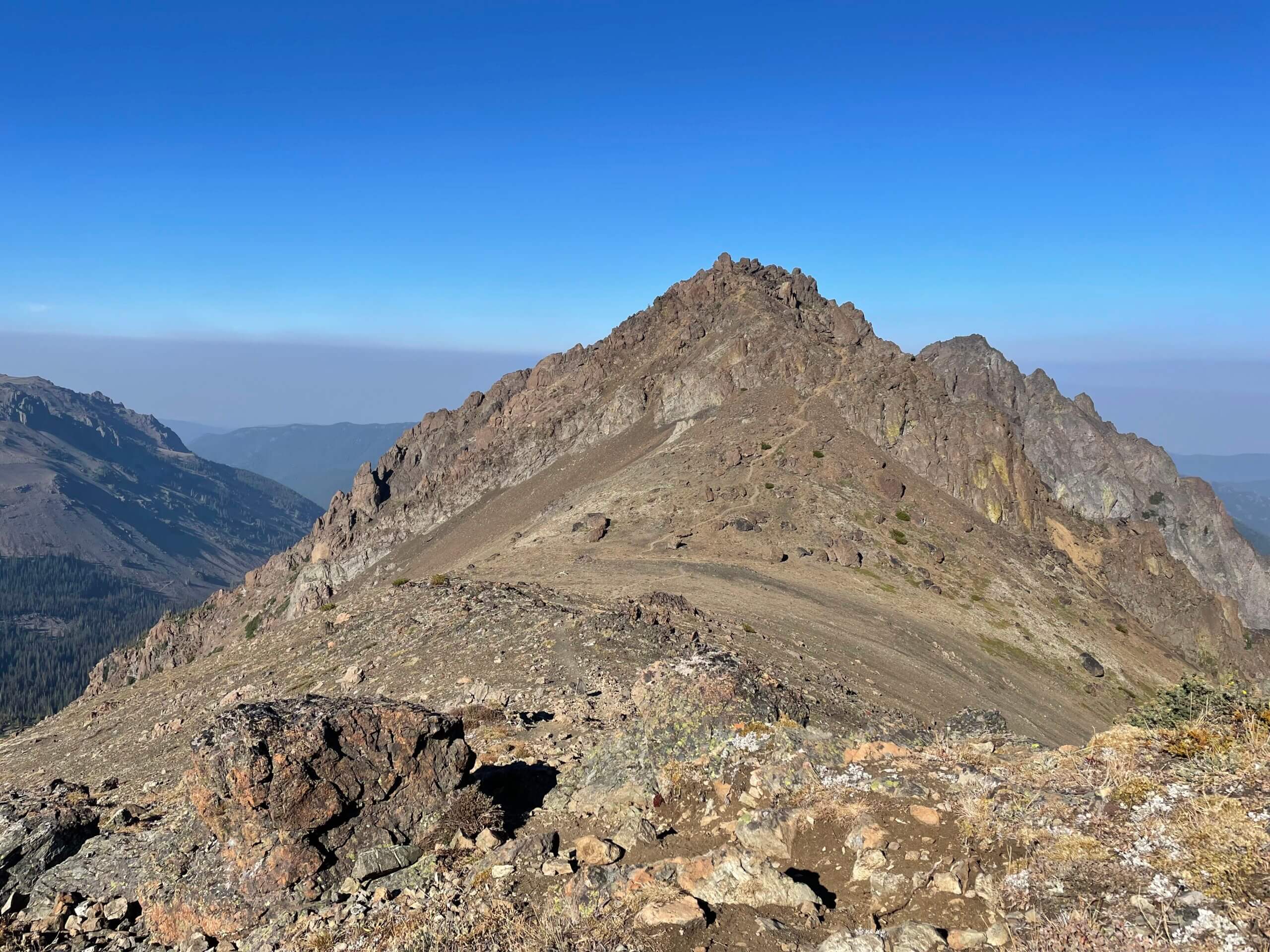
The other option is to bear left when that trail splits and carry on along the Tubal Cain Trail until you reach an open meadow ridge about 1- 1 ½ miles along. There will be the ability to continue along the trail to Buckhorn Lake or turn right at the T to head up a gentler route to Buckhorn Mountain.
Tubal Cain Trail to the Tubal Cain Mine Trail
This trail goes past Buckhorn Lake and is a 7.2-mile (round-trip) trail within the Buckhorn Wilderness and leads to the old Tubal Cain Mine site. Also at this site is the ruins of a 1952 B-17 plane. There is an elevation gain of 1,600 feet and is another direction in which you can access Marmot Pass from.
Boulder Camp and Upper Dungeness Trail
This is another gateway trail to Marmot Pass and is 16.2 miles roundtrip with a 3,500-foot elevation gain. Boulder shelter is at about 6.4-miles into the trail. Make sure to check the local trail information before heading out as Boulder Camp has in the past taken some damage from avalanche and depending on the damage the shelter that has historically been there may be no more.
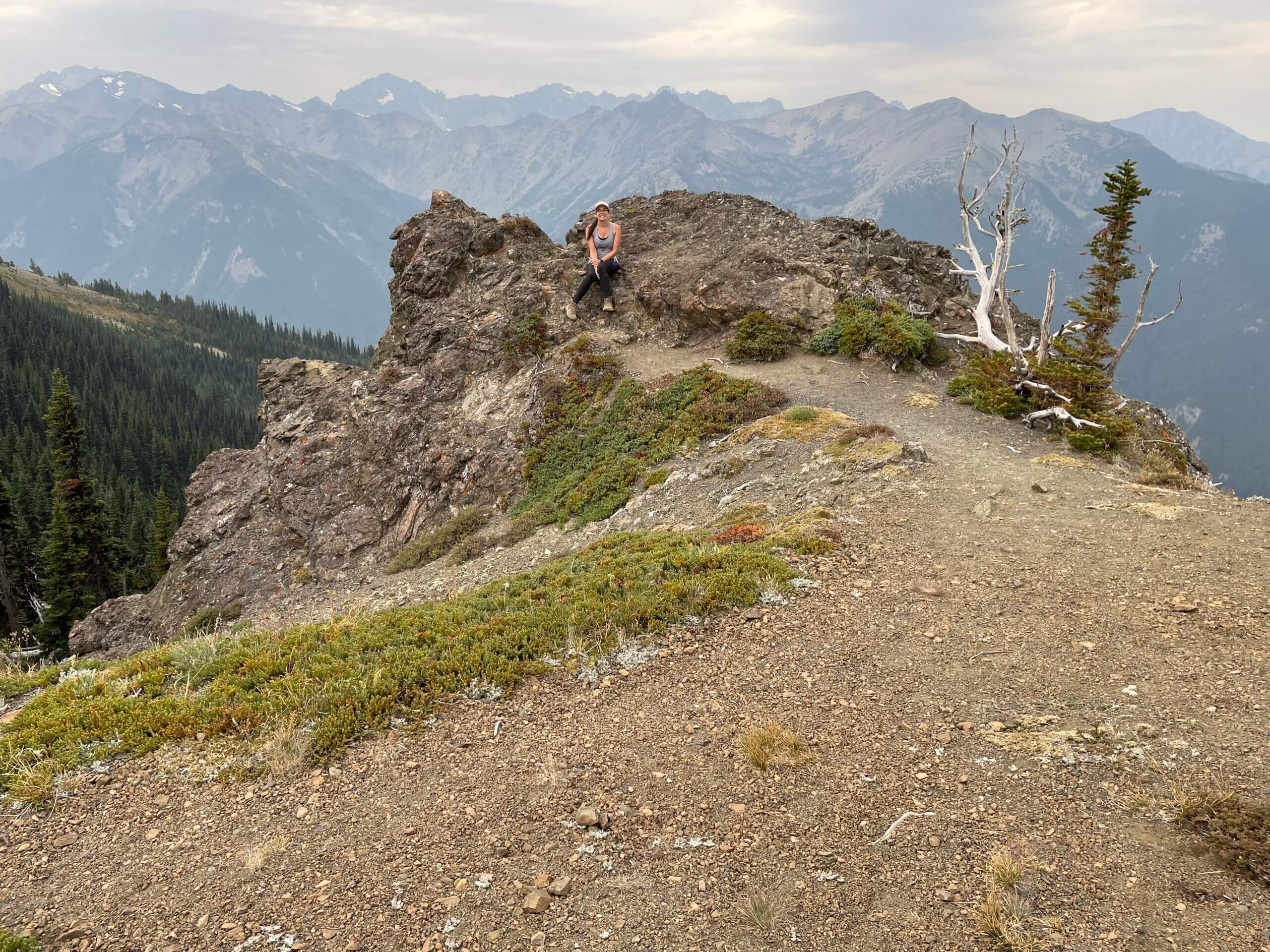
Hike up for the best views of the Olympic mountains (unnamed trail)
When you reach Marmot Pass, where the trail branches off there is a side trail that heads up a ridge that on a clear day gives you unbelievable panoramic views of the meadow and the surrounding mountains. There are also a couple of campsites hidden in there that would be a great place to spend a few days, just bear in mind that there is no water access here so bring lots.
Wildlife
There are bears and mountain lions in the area, so make sure to bring either a bear canister or hang your food bag at least 100 feet from your site. The trees are stunted here at elevation, so finding a high enough tree can be real challenge.
You are likely to see Marmots in Marmot Pass (just makes sense, right?) and occasionally you will see mountain goats as well.
Concluding Thoughts
Marmot Pass is the perfect place to go to get away from it all. The silence here is complete. If you don’t want the crowds of the national park and want to just go somewhere to reset, this is the perfect hike for that.
Hike to the pass in a day or take your time and spend a couple nights just wandering around and taking in the beauty of the area.
Looking for more great trails? Check out my Guide to Glacier National Park.