*This post contains affiliate links, if you click a link I make a small commission and you help support the blog
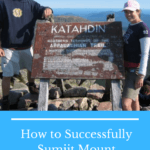
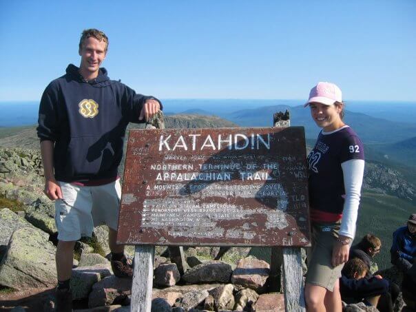
Mount Katahdin, translated to “Greatest Mountain,” was my first big climb and at the time the hardest hike I had ever done. It definitely pushed me outside my comfort zone, but was the beginning of my obsession with hiking and mountains. With 4,000 feet of elevation gain and a 5.2 mile walk one way its definitely a challenge and the last section for those hiking northbound on the Appalachian trail.
For a successful summit of Mount Katahdin it takes some preparation and looking back now there are things I could have done differently. For those who are thinking about attempting this hike for the first time, there are a few things to consider and some planning involved. This guide will help you plan for a successful summit of your own.
Getting there and staying
Located in the northern part of Maine, the closest town, just 17 miles from the park, is Millinocket. It’s a great spot as your last fill up for any gear or food you may need. Most people, however, will drive in taking advantage of the many campgrounds within the 209,644 acres of park.
Main campgrounds in the area include Roaring Brook campground, Abol campground, Chimney Pond Campground and the Katahdin Stream Campground, which is where we stayed prior to our hike up the Hunt trail.
There is a parking lot at the Katahdin Stream Campground for those planning to hike the Hunt trail to the summit. If you are planning to day hike Katahdin and not camp, it is recommended you make a parking reservation to ensure you get a parking spot when you arrive.
If you intend to camp, you will need to make reservations for camping well in advance. You can tent or reserve a lean-to. If you are driving into the park, there is a $14 non-resident fee per car. Keep in mind that visitor numbers are tightly controlled and the park only allows a certain number of people in per day.
I would recommend reserving a campsite, because it’s a long hiking day to the summit and back and you will need to get an early start to have enough time to fully enjoy it. We started our hike in the early morning hours, around 3AM, to ensure we had plenty of time to summit and get back before it got dark again.
So, bring a headlamp for those first couple hours of hiking, which is arguably the easiest part of the trail, before you get into the steep, more technical sections higher up the mountain.
Weather and peak season
The weather on the mountain can be extremely unpredictable. You can have severe weather even during the peak season in the middle of the summer. And with the remote location, if you get caught in bad weather, a rescue is extremely difficult. During my climb, we met two hikers on their way off the mountain in the early morning hours. They had been stranded on the top thanks to some snow and hail that hit them the previous day. This was in August.
Luckily, we had a good day for our hike, but the summit and even sections on route to the top are very exposed. The clouds, as we all know, like to hang out around mountain tops, creating their own weather patterns.
When you arrive to the camping area at the base of the mountain keep an eye on their weather updates and plan your trek accordingly. Plan for an 8-12-hour hike, during which weather and temperatures can change quickly.
Gear
It may not be one of the seven summits but it is still a challenge. One that will take you the majority of the day. Therefore, going prepared will only breed a higher chance of success.
Pack
Go as light as possible. I know for you more experienced backpackers you get it. You don’t need to be told this. I was so naïve when I hiked this trail. I took the only pack I had, which was not the best option on the market (it was cheap, I was a student with no money).
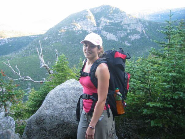
Try to set yourself up for success and don’t overburden yourself with a heavy pack. The trail is hard enough on its own. Check out my packing list for hiking Mount Katahdin for more specific recommendations.
Food and water
It’s going to take you 8-12 hours to do this whole thing, there and back. So, make sure you have energy dense foods to get you through and enough water to stay hydrated. On most trails there are little to no water sources so you need to pack enough for the entire trip.
Clothing
The weather is unpredictable and the majority of trails are very exposed, so make sure you have various layers with you. I know it can add weight to your pack but it can be cold on the top and extremely hot on the way up, if you are going during the June-August season (which is the best time of year to attempt the climb).
Safety
This might not be in the ranks of the 7 summits or even the 14,000-footers of the west coast, but don’t be stupid. It’s not ranked extremely strenuous and difficult for fun. There are boulder fields to climb and the possibility of going off trail if you’re not careful (this happened to me in the boulder field).
Bring a first-aid kit, you can purchase small, light-weight ones at various retail outlets, like REI. Know your limitations. Follow the blazes. Stay mindful and aware while you are hiking, don’t just go into autopilot and lose sight of where you are and what’s around you.
Miscellaneous
Don’t forget the little things, like sunscreen and bug spray. Maine is notorious for mosquitos and black flies and you will feel like you are being eaten alive. And because most of these trails are so exposed, make sure to protect your skin from the sun. Bring a hat to protect that precious skin on top of your head. If you are anything like me, this is the first place I burn.
Intensity and fitness
I climbed Katahdin without any prior preparation. Honestly, I kind of did it on a whim, having never done anything like it before. People told me I wouldn’t be able to do it. I made it, but there were definitely times when I questioned my sanity. And I couldn’t walk for days after. It’s a challenging climb and I took it too lightly. Don’t be me.
If you are able, I would recommend doing some local hikes in your own area of varying difficulty to build up those hiking muscles. If you are part of a gym some of the best exercises you can do include squats (as much as I hate those) and the stair climber (I also hate this).
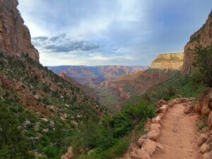
Katahdin is no joke. Depending on the trail you choose you could be hiking around 3 miles with an elevation gain on average of 4,000 feet in mostly exposed conditions. It’s rocky, strenuous and extremely difficult. Not something you should take lightly, otherwise you put yourself at risk of serious injury.
Trail options
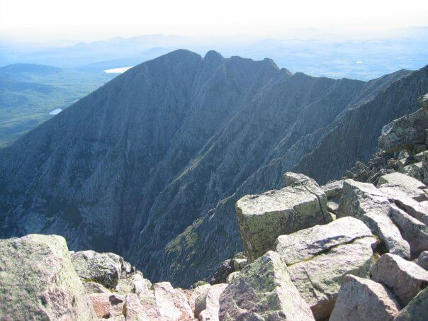
There are 220 miles of trail within the 209,644 acres of Baxter State Park, 16% of which are on Katahdin. There are 9 trail options for reaching the summit of Katahdin, including the knife edge trail. This 1.1-mile trail scares the bejesus out of me with a steep drop on either side at the highest point on the mountain. If you get vertigo, this trail is not for you.
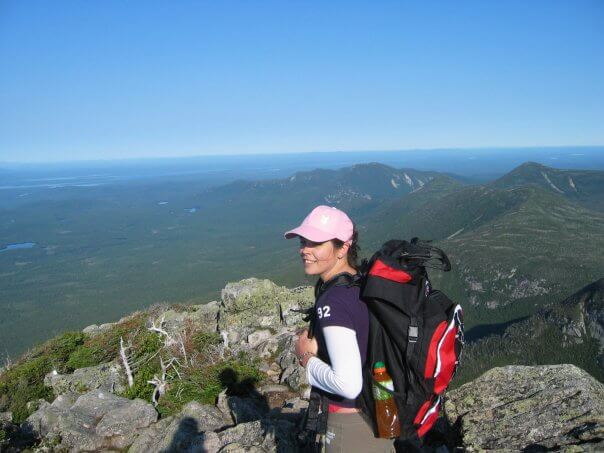
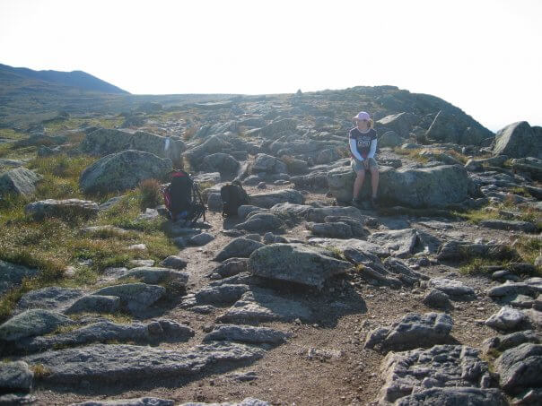
We took the Hunt trail from Katahdin Stream Campground. This is one of the most popular trails to the summit, with spectacular views. A total of 5.2 miles and an elevation gain of 4,188-ft you pass through a multitude of features, including the Boulders, which was the steepest section, on Hunt Spur, and the Tableland. 2.4-miles of this trail is above the tree line, giving you some of the best views of any trail.
If you are looking for the shortest route to the top you will want to take the Abol Trail. 4.4 miles long (with 1 mile of that on the Hunt Trail) and an elevation gain of 3,982-ft this trail is still very strenuous and very exposed. Make sure you plan accordingly.
For the most gradual ascent you will want to take the Saddle Trail. While the other trails are labeled “extremely strenuous” this one is “strenuous” if that gives you any comfort.
Other potential trails include Helon Taylor, Dudley (which is closed at the time of writing this), Cathedral, Hamlin Ridge, and Chimney Pond.
Concluding Thoughts
Make sure to stop at the ranger’s station when you arrive. It’s always a good place to get the most up to date info on weather conditions on the actual mountain and trail updates, including wildlife sightings and trail closings or trail rerouting. This goes for any hike or mountain you plan to attempt. The rangers know the area best and the internet doesn’t always have the most updated information.
No matter which you choose, you are guaranteed an incredible adventure, with fantastic views and a serious challenge. Which trail did you take? What are your recommendations? Want to know more? Check out my trail guide on hiking Mount Katahdin.

Comments
Traveller Loop will not take you anywhere near Mt Katahdin. It is in tbe north end of the park.
Author
Oh thank you for letting me know! I am going to remove that, don’t want to be spreading misinformation and result in a bad experience for someone! I have not had a chance to experience all the trails in Baxter State Park or the one’s leading to Katahdin, just the one. My research seems to have led me astray a bit but I am glad you brought it to my attention! Thanks again!
Pingback: What to pack to summit Mount Katahdin - Wandering with a Dromomaniac
Thank you for the useful information! I’m in Virginia and may never make it to Maine for this summit, but enjoyed reading about it and having a vicarious hike.
Author
Thank you Maggie! I hope one day you do get up to Maine to tackle the summit but if not there many other adventures out there to be had, many in Virginia!
My husband and I did this a few years ago and we went up Cathedral. Holy Hannah. More rock climbing than hiking to be honest! But a ton a fun! We are planning our next trip early this fall and are debating between Abol and Hunt!
Author
Rock climbing will definitely take a lot out of you! I learned that lesson on the Presidential Traverse in New Hampshire. I highly recommend the Hunt trail. There is some bouldering in one part of that trail and sometimes the marks on the rocks look like white blazes and are not, so be careful of that (we got a little off trail there). Otherwise, there is some beautiful hiking in the woods and the alpine area and then the tableland area is incredible. I really liked how varied this trail was and am hoping to do the 100-mile wilderness in the near future and maybe tackle Abol. Let me know which you choose and how you liked it!
So u r to follow the white marks on the boulders, is that right? R u saying Hunt trail has less boulders than other trails? Gracias!
Author
I would say that the Hunt trail has a pretty serious boulder field that you need to navigate but if you follow the white blazes, being mindful that sometimes the rocks have white marks that can look like a blaze but are not, you should be fine. When I did it I wasn’t paying close enough attention to the blazes and I started following white marks on the rocks that were not blazes and ended up getting off track, so just keep your eyes peeled for rectangular white blazes. Good luck!
I hike the AT in and just S. of Shenandoah National Park 3x/week, just over 25 miles a week. I’m 67. I made a reservation to hike the Hunt trail in 2 weeks. My question is whether going down places you’ve gone up OK is risky. I’ve done bolder scrambles, but are there blind drops of 3-4 feet where you can easily miss your footing. I don’t want to get up fine and then find I’m in trouble getting back down.
Author
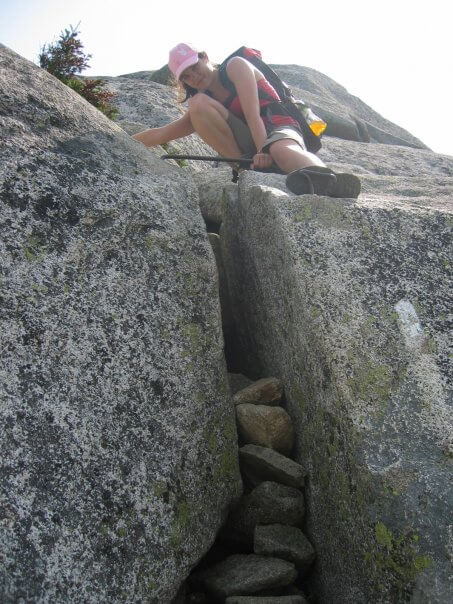
Hi Dan, that’s a great question. No there are no blind drops along the trail. It’s manageable going both up and down. There is one spot, which I have a picture of where they put in a handle bar to help but the rest is manageable by hand and foot. Enjoy! It’s an awesome hike, make sure to check the weather the day before and to get an early start to give yourself enough time to get up and back and be able to enjoy it without rushing.
Pingback: The Ultimate Guide to Hiking Mount Pico - Wandering with a Dromomaniac
Thank you for your very informative report on Mt Katahdin. My best friend and I have challenged ourselves to hike it this June. We are preparing by hiking in multiple locations around the state and once we succeed in this challenge we are off to hike a bit in Colorado with my brother. Your article is fantastic and helps me know more of what to expect so I am prepared.
Author
Oh I’m so glad that you found it helpful! Enjoy the climb and let me know how it goes!
Oh my goodness! Are you ever right!
We had a son complete the AT. My husband and I the idea we would all (along with the hiker’s brother and sister) join him on his last 5.2 miles to the top and finish of Mt Katahdin. I had trained all summer for a triathlon and my husband had been running. We thought we were in pretty good shape (Maybe we were -for a triathlon, but not for this difficult hike) We had to use a whole set of different muscles for this little jaunt.
My husband’s legs gave out on the way up and at some point mine gave out on the way down. We had to keep going because our children had arrived at the top (way ahead of us.) They waited and we joined them for photos. They then took off and arrived back down to our campsite (way ahead of us.) We eventually made it (it was dark when we got back to camp. I struggled walking for about 2 days after. We laugh about it now. We are still glad we did the last bit of the trail with our son and other children, but we had no idea of how strenuous it was going to be.
Author
You are 100% right, it’s a challenge! But what a wonderful experience that must have been to be there when your son finished the AT! What an accomplishment, you must have been so very proud, even in the physical pain. I always find that during the adventure and discomfort I wonder what I was thinking and several weeks (sometimes even just a couple days) later after the journey was over I can’t help but smile over what I had done and the adventure I had. I hope you feel that same way.
Helon Taylor Trail- knifes edge and back down saddle back is by far the hardest route you can do. And out of the 4 trails I’ve done helon is the most exposed. A lot of scrambling sun exposure and by the time you’re at chimney your legs are toast
Author
Thanks for the info! That’s really good to know.
Pingback: Hiking Mount Katahdin in Baxter State Park, Maine
Pingback: 8 of America’s most dangerous hikes for experienced hikers
Pingback: Preparing to climb Europe’s highest mountain: Mount Elbrus
Thanks for this information. Going to try it!
Author
Good luck and enjoy!